New integration brings AirMap airspace intelligence to the Kespry platform for automated drone operations
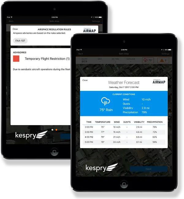
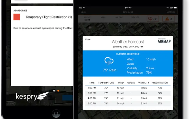
AirMap-Kespry integration brings AirMap’s airspace intelligence to the Kespry flight app.
Credit: DRONELIFE.com
Santa Monica, CA (November 9, 2017) –
Kespry manufactures the autonomous Kespry drone, part of an end-to-end flight planning and data analytics platform that provides customers in mining, construction, insurance, and other industries with actionable business insights. The Kespry drone can take off, gather high-resolution aerial data, avoid obstacles, and land without the help of a human pilot, helping industry customers scale their operations easily and efficiently.
“Kespry focuses on providing a complete solution for our industrial customers,” said George Mathew, CEO and chairman of Kespry. “The integration of AirMap’s airspace and weather notification data directly into our application will enable our users to make decisions about flight safety and compliance directly within our autonomous flight planning application.”
The new AirMap-Kespry integration brings AirMap’s airspace intelligence to the Kespry flight app. During the flight planning process, the app automatically surfaces AirMap airspace advisories, wind, and weather tailored to the unique parameters of each flight, including the drone operator’s pilot certification. Preflight checks are easier than ever before, autofilling this information in each mission plan to help operators move more quickly from field, to flight, to finish. Airspace rules, temporary flight restrictions, and the locations of schools, prisons, hospitals, power plants, and more can be viewed with just a tap.
The result is a richer, more streamlined experience that makes situational awareness and flight planning effortless for Kespry customers.
Kespry is the first in the drone industry to integrate airspace intelligence from AirMap’s contextual airspace offering, which tailors rules and conditions to the exact specifications of each mission, including operator certification, flight location, and speed, height, and weight requirements. Contextual airspace features are currently available to users of AirMap’s web and mobile apps, and will be released to the entire AirMap community via a contextual airspace API in 2018.
“Kespry customers are flying complex new missions every day, changing the face of industries like construction, mining, and insurance,” said AirMap CEO Ben Marcus. “By pairing AirMap intelligence and Kespry insights, drone operators can fly with more confidence than ever before. Safe, efficient, compliant drone flights are easy with AirMap and Kespry – an exciting example of how the AirMap platform powers drone innovation across the industry.”
About Kespry
Kespry’s aerial intelligence platform is transforming how organizations capture, analyze and share insights about their business, providing the information they need to accelerate their operations. Purpose-built for industrial use yet simple enough for any user, a wide variety of industries rely on Kespry to solve business-critical problems. Delivering a fully integrated solution from drone data capture to industry-specific analytics, Kespry serves customers across North America, Europe and Australia, including Farmers Insurance, Hancock Claims Consultants, Catastrophe Response Unit (CRU), Fluor, Lehigh Hanson/Heidelberg, and Sully-Miller/Colas USA.
About AirMap
AirMap is the world’s leading airspace management platform for drones. Millions of drones, hundreds of drone manufacturers and developers, and hundreds of airspace managers and stakeholders rely on AirMap’s airspace intelligence and services to fly safely and communicate with others in low-altitude airspace.
Media Contact:
Steve Smith
Steve.Smith@allisonpr.com
+1.206.686.6426