
Tag "Drone"
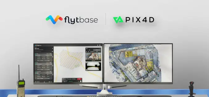
FlytBase and Pix4D Partner to Streamline Drone Data Processing Workflows
FlytBase, the leading drone autonomy software platform, announces a strategic partnership with Pix4D, the leading photogrammetry platform for terrestrial and drone mapping. This integration will enable FlytBase users to seamlessly
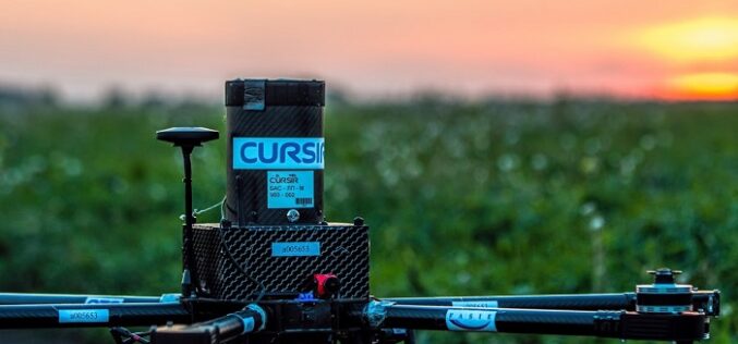
NAVAID Calibration Drone by Cursir Helped to Speed Up the Flight Check of the Landing System of the Ulyanovsk Airport
Last year, by order of the Federal Air Transport Agency of Russia, a working group was created on the implementation of UAVs to calibrate, check and configure navigation aids at

Pix4D Announces Entering Into An Exclusive Reseller Partnership With Beijing Skymap Technology Co., Ltd. For Mainland China
Pix4D, the photogrammetry industry leader, today announced the signing of an exclusive reseller partnership with Beijing Skymap Technology Co., Ltd. a high-tech enterprise integrating software sales, service, research and development,
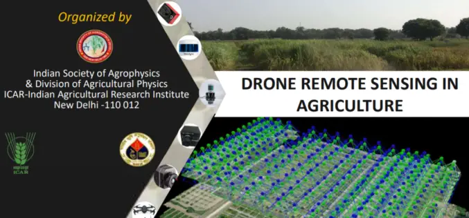
Full-Day Webinar on Drone Remote Sensing in Agriculture
Indian Society of Agro-Physics in association with ICAR- IARI is organizing one day webinar on Drone Remote Sensing in Agriculture. Hurry last date to apply is August 31, 2020.

“MyGalileoDrone Competition 2020” Submission Open!
The European GNSS Agency (GSA), the operational agency of the European Commission for Galileo and EGNOS has launched its MyGalileoDrone competition on July 17. The increasing availability of Galileo–enabled
Centrik and Flock Sign Strategic Alliance to Deliver Data-Driven Reduced Risk Operations for The Drone Sector
Operational management system supplier Centrik and specialist drone and eVTOL insurance provider Flock have formed a strategic alliance to raise safety standards and reduce risk in commercial drone operations.
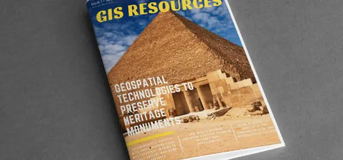
GIS Resources Magazine (Issue 1 | March 2020): Geospatial Technologies to Preserve Heritage Monuments
GIS Resources is pleased to announce the release of its 1st edition (March 2020) of the print and digital magazine. The edition titled “Geospatial Technologies to Preserve Heritage Monuments” focuses
SimActive Announces New Drone Training Program for Mapping
February 03, 2020 – SimActive announces a new training program for drone mapping. The program’s goal is to provide educational material and resources on how to effectively process drone imagery,

RME Geomatics Delivers Innovative Drone Technology for Government-Funded Build in Canada Innovation Program (BCIP)
Carp, Ontario– RME Geomatics, a world leading aerial survey services and technology company, announced today they have delivered a Renegade-M aircraft under the Canadian Federal Government Build in Canada Innovation
Trimble Inpho UASMaster 9.1 Now Available
UASMaster is one of Trimble’s UAS processing software solutions. UASMaster is engineered on the basis of the well-established Inpho advanced airborne photogrammetry/airborne LiDAR processing software suite. It offers full automatic geo-referencing, point-cloud
