
Posts From GIS Resources

Sokkia Announces New Compatibility with Autodesk Layout Application
Sokkia announces its new iX robotic total station series’ compatibility with the Autodesk BIM 360 Layout application. BIM 360 Layout is designed to provide vertical construction contractors the ability to
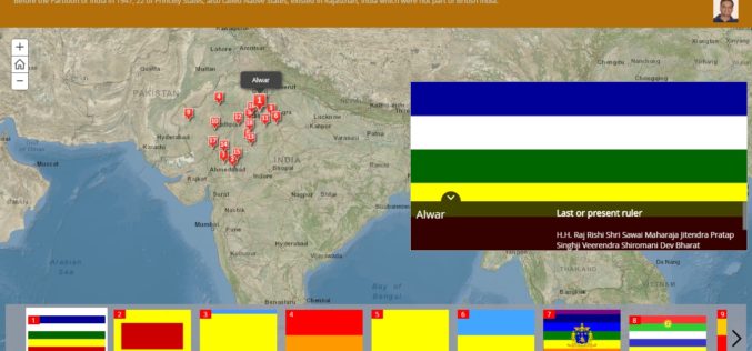
History of Princely States of Rajasthan through Story Map
Contributed By: Before the Partition of India in 1947, there was 562 Princely States existed in the Indian subcontinent which had not been conquered or annexed by the British but was subject
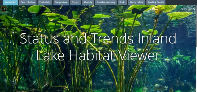
Michigan Department of Natural Resources Launches New Web-based Mapping Tool
The Michigan Department of Natural Resources has recently launched a new web-based mapping tool – the Inland Lake Habitat Viewer – to provide the public with information about the state’s inland lakes.

UAE to Adopt Space Technology for Farming
According to the recent news reported by the Gulf News, the UAE Space Agency has recently hosted senior Japanese officials at its Abu Dhabi headquarters for talks on applying space
Earth on AWS: Large Geospatial Datasets Available on the Amazon Web Services
Amazon Web Services (AWS) had launched the Landsat on AWS in the year of 2015, a Public Dataset made up of imagery from the Landsat 8 satellite. On September 16, 2016 (AWS Blog),
What Transforms the Digital City into the Smart City?
Public participation makes the digital city truly smart Hamburg, Darmstadt 16 September 2016 | Involving the public is transforming the digital city into the smart city of the future. With

Airbus Defence and Space Invests in Very High-Resolution Satellite Imagery from 2020 Onwards
-Four very high-resolution (VHR) optical Earth observation satellites to be launched in 2020 and 2021 will ensure continuity of Pléiades misión – Highly responsive dual VHR constellation will offer state-of-the-art
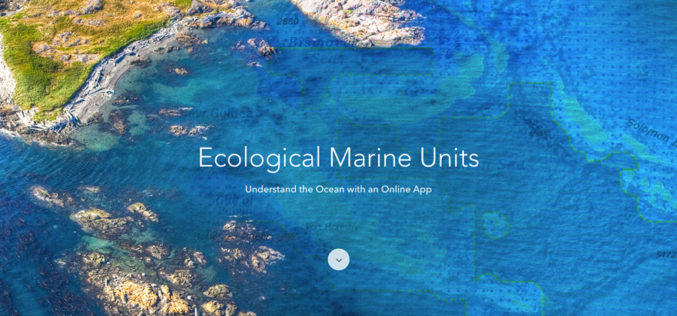
Esri Releases EMUs to Understand the Ocean
GIS Enables a New Way to Measure Marine Environments Redlands, California—Esri, the world leader in smart mapping technology, announced a whole new way of measuring the ocean on September 15,
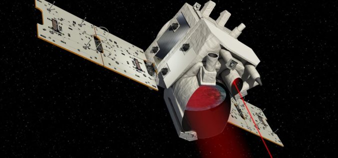
DLR and CNES Sign an Agreement for the Construction and Operation of the MERLIN Environmental Satellite
On 14 September 2016 in Berlin, the German Aerospace Center (Deutsches Zentrum für Luft- und Raumfahrt; DLR) and the French space agency (Centre national d’études spatiales; CNES) signed a cooperation
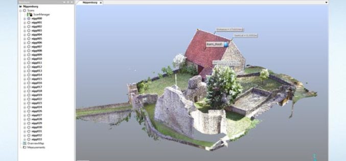
FARO Releases SCENE Version 6.1, Introducing a Fully Integrated Point Cloud to 3D Mesh Engine for Product Design and Construction BIM-CIM Professionals
Lake Mary, FL, September 6, 2016, 2016 – FARO (NASDAQ:FARO), the world’s most trusted source for 3D measurement and imaging solutions for factory metrology, product design, construction BIM/CIM, public safety
