
Posts From GIS Resources

Pakistan to Launch First Remote Sensing Satellite by 2018
Islamabad [Pakistan], According to recent news by the ANI, with space technology being used in the planning and monitoring of China-Pakistan Economic Corridor (CPEC) projects, the Pakistan Space and Upper

LiDAR Technology for Monitoring Bridge Structure Defect and Health
Road infrastructure of a country plays a crucial role in the national economy. Among all road infrastructure, Bridges are one of the vital assets and histories has given us various evidence
SuperGIS Server 3.3 Is Now Released!
SuperGIS Server 3.3.0001, the latest version of SuperGIS Server is now released! In this version, the most distinguishable feature will be the new ultra application, which has not only a
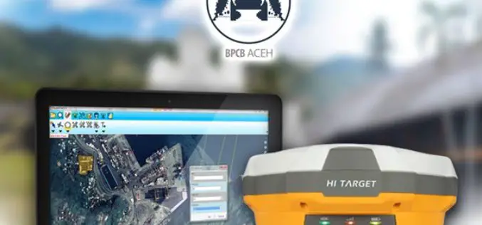
SuperPad Helps Cultural Heritage Preservation in Aceh
The worldwide GIS software and solution provider, Supergeo is pleased to announce that the full-featured mobile GIS software, SuperPad, has been selected by BPCB Aceh to assist heritage preservation in
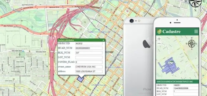
OGC Requests Participation in its Land Administration DWG
The Open Geospatial Consortium (OGC®) is calling for public participation in its newly-established Land Administration Domain Working Group (Land Admin DWG). Worldwide, effective and efficient land administration is an ongoing

PCI Geomatics and PrecisionHawk Enter into Long Term Partnership
MARKHAM, Ontario, Canada—September 20, 2016: PCI Geomatics, a world-leading developer of remote sensing and photogrammetric software and systems, announced today it has entered into a long-term partnership with PrecisionHawk, a
Esri Named among the Top 25 Fastest Growing Cloud Companies
PwC Report Explores Ways Cloud Computing Combats Margin and Pricing Pressure by Adding Value, Speed, and Scalability Redlands, California, September 20, 2016—Smart mapping leader Esri announced today that it has
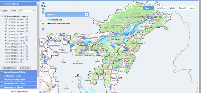
NRSC Released Updated Flood Hazard Atlas for Assam State
According to recent news by ISRO, the National Remote Sensing Centre (NRSC), ISRO, Hyderabad has released updated flood hazard atlas of Assam, a highly flood-prone state of India. Assam is

NASA ARSET – Remote Sensing Training: Methods & Best Practices
Remote Sensing Training: Methods & Best Practices Thursdays, October 13-27, 2016 10:00 – 11:30 a.m. and 5:00 – 6:30 p.m. EDT (UTC-4) The goal of the NASA Applied Remote Sensing

SimActive Brings Picture-in-Picture 3D Viewing with Version 6.5
SEPTEMBER 20, 2016 – SimActive Inc., a world-leading developer of photogrammetry software, is pleased to announce Correlator3D™ version 6.5 with a new picture-in-picture (PiP) feature. The PiP brings a 3D rendered
