GIS Enables a New Way to Measure Marine Environments
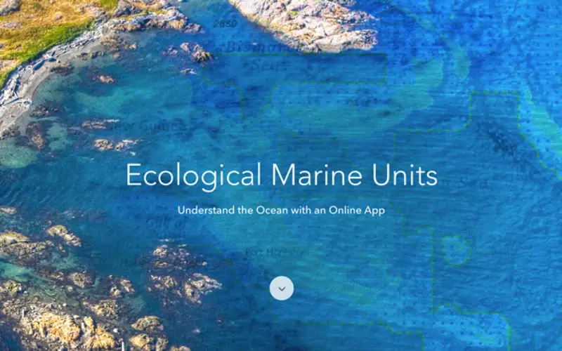
Redlands, California—Esri, the world leader in smart mapping technology, announced a whole new way of measuring the ocean on September 15, 2016, at the Oceans Conference in Washington, DC. Ecological Marine Units (EMUs) are Esri’s gift to a world whose final unexplored terrain lies beneath its seas.
Esri and USGS collected a series of global measurements representing the ocean’s physical and chemical properties most likely to drive ecosystem responses. From millions of measurements taken, 37 physically and chemically distinct volumetric regions, or EMUs, were statistically derived. EMUs differ from existing maps of marine ecoregions since they are globally comprehensive, data-driven, and 3-D. The primary data source is NOAA’s authoritative World Ocean Atlas.
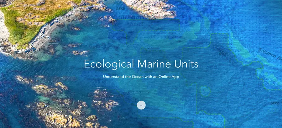
Ecological Marine Units (EMUs) are Esri’s gift to a world whose final unexplored terrain lies beneath its seas. Credit: Esri
“Our world’s last unknown great space, the ocean between its surface and its floor, is also one of the last frontiers of mapping,” said Dr. Suzette Kimball, Director of the U.S. Geological Survey. “In light of our long history of making scientific maps at USGS, I am especially proud to report that the USGS has partnered with Esri, NOAA, academia, and several non-profit organizations to produce a new, comprehensive map of the global ocean. The map is presented in the form of volumetric global ecological marine units (EMUs) that, combined, provide a three-dimensional perspective of the ocean’s staggering dimensions and complexity.”
Built by an innovative public-private partnership led by Esri and the USGS, EMUs provide a standardized, rigorous, and ecologically meaningful set of ocean ecosystem units. Therefore, they may be used as a basemap for things like climate change impact studies, biodiversity priority settings, economic and social valuation studies, or marine spatial planning.
“While oceans cover about 70 percent of the Earth’s surface, the impact of climate change on the oceans, apart from sea level rise, has largely been hidden,” said Dr. Kimball. “This easily accessible map will serve as a fresh resource for improving our understanding of the ocean’s structure—its salinity, temperature, oxygen levels, and nutrients—in millions of specific places. This added insight will in turn help us better understand the rapid changes in ocean ecology that are now happening around the world.”
Esri has made the EMUs accessible via the EMU Explorer Web app, and in November will make this geospatial information available to Esri’s ArcGIS platform users as maps in the Living Atlas of the World and as downloadable datasets for open use.
“It’s an exciting time when our abilities to measure ocean phenomena are met by new ways to analyze and model the oceans using GIS,” said Esri program manager for ArcGIS content, Sean Breyer. “The work of marine researchers in mapping the vast areas of our oceans that remain uncharted is vital so that we can understand the future of our oceans.”
To explore Esri’s Ecological Marine Units ArcGIS Online Group to access extra resources, data, and tools, accessible at go.esri.com/pr-emu.
# # #
Press Information:
Karen Richardson, Esri
Tel.: 909-793-2853, extension 1-3491
E-mail (press only): press@esri.com
General Information: info@esri.com