

Posts From GIS Resources

SuperPad Helps Cultural Heritage Preservation in Aceh
The worldwide GIS software and solution provider, Supergeo is pleased to announce that the full-featured mobile GIS software, SuperPad, has been selected by BPCB Aceh to assist heritage preservation in

OGC Requests Participation in its Land Administration DWG
The Open Geospatial Consortium (OGC®) is calling for public participation in its newly-established Land Administration Domain Working Group (Land Admin DWG). Worldwide, effective and efficient land administration is an ongoing

PCI Geomatics and PrecisionHawk Enter into Long Term Partnership
MARKHAM, Ontario, Canada—September 20, 2016: PCI Geomatics, a world-leading developer of remote sensing and photogrammetric software and systems, announced today it has entered into a long-term partnership with PrecisionHawk, a

Esri Named among the Top 25 Fastest Growing Cloud Companies
PwC Report Explores Ways Cloud Computing Combats Margin and Pricing Pressure by Adding Value, Speed, and Scalability Redlands, California, September 20, 2016—Smart mapping leader Esri announced today that it has
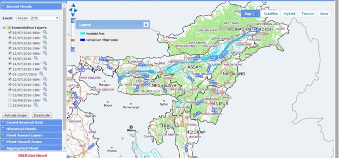
NRSC Released Updated Flood Hazard Atlas for Assam State
According to recent news by ISRO, the National Remote Sensing Centre (NRSC), ISRO, Hyderabad has released updated flood hazard atlas of Assam, a highly flood-prone state of India. Assam is

NASA ARSET – Remote Sensing Training: Methods & Best Practices
Remote Sensing Training: Methods & Best Practices Thursdays, October 13-27, 2016 10:00 – 11:30 a.m. and 5:00 – 6:30 p.m. EDT (UTC-4) The goal of the NASA Applied Remote Sensing

SimActive Brings Picture-in-Picture 3D Viewing with Version 6.5
SEPTEMBER 20, 2016 – SimActive Inc., a world-leading developer of photogrammetry software, is pleased to announce Correlator3D™ version 6.5 with a new picture-in-picture (PiP) feature. The PiP brings a 3D rendered

Sokkia Announces New Compatibility with Autodesk Layout Application
Sokkia announces its new iX robotic total station series’ compatibility with the Autodesk BIM 360 Layout application. BIM 360 Layout is designed to provide vertical construction contractors the ability to
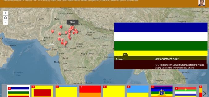
History of Princely States of Rajasthan through Story Map
Contributed By: Before the Partition of India in 1947, there was 562 Princely States existed in the Indian subcontinent which had not been conquered or annexed by the British but was subject

Michigan Department of Natural Resources Launches New Web-based Mapping Tool
The Michigan Department of Natural Resources has recently launched a new web-based mapping tool – the Inland Lake Habitat Viewer – to provide the public with information about the state’s inland lakes.
