
Posts From GIS Resources
GIS Resources Magazine (Issue 3 | September 2023): Geospatial Technologies for Climate Change Mitigation
GIS Resources is pleased to announce the publication of its 3rd edition (September 2023) of the print and digital magazine. The edition is titled “Geospatial Technologies for Climate Change Mitigation.” Amid

Chandrayaan 3 – Exploring the Moon’s Surface
Chandrayaan-3, India’s eagerly awaited lunar exploration mission, achieved a resounding success as it embarked on its journey to the Moon and flawlessly executed the landing of its lander named Vikram

Thrilled to Announce We Partnered with DroneX Tradeshow & Conference
We are thrilled to announce we are partnered with DroneX Tradeshow & Conference this year! Make sure to mark your calendars on the 26th & 27th of September and get

Cold Climate Preparedness: How Insulated Shelters Enhance Remote Operations
Insulated shelters, particularly tailored for extreme environments, have become the unsung heroes of remote operations worldwide. Whether providing a haven for researchers in the Arctic or safeguarding equipment in desert
A Case for Geospatial Development Program (GEO-DP)
The Geospatial Development Program (GEO-DP) is an Engineer Regiment Program that leverages senior lieutenants/junior captains to provide additional officers to geospatial units while developing the officers’ geospatial skills, thereby increasing

Fathom Revolutionizes Flood Risk Intelligence With New US Flood Map
Global flood risk intelligence firm Fathom unveils the most complete and technologically advanced flood map for the US Fathom, a global leader in water risk intelligence, has released a new
FAIRiCUBE Goes IGARSS
Inspiring days we had: The FAIRiCUBE team is looking back to a successful participation at this year’s International Geoscience and Remote Sensing Symposium (IGARSS), which took place in Pasadena, California,
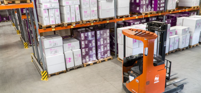
8 Proven Ways to Improve Your Supply Chain Management
Supply chain management aims to optimize the movement of goods and services to cut costs and improve the overall customer experience. Every business that sells tangible goods now relies heavily
GIS Resources Magazine (Issue 2 | June 2023): Geospatial Technologies for Nation Development Contribution
GIS Resources is pleased to announce the publication of its 2nd edition (June 2023) of the print and digital magazine. The edition is titled “Geospatial Technologies for Nation Development Contribution.” Geospatial
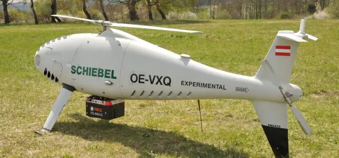
Successful Integration of the RIEGL VQ-840-G Topo-Bathymetric Laser Scanner into the Schiebel CAMCOPTER® S-100 UAS
RIEGL Laser Measurement Systems GmbH and SCHIEBEL have successfully completed the integration of a high-end laser scanning system, the RIEGL VQ-840-G topo-bathymetric LiDAR sensor, on the Schiebel CAMCOPTER® S-100 Unmanned
