
Posts From GIS Resources

How Geospatial Technology Optimizes Polyethylene Transporter Tanks
Logistics and supply chains increasingly utilize geospatial technology. This provides real-time data for key decisions like cutting transport costs. Geospatial tech enables route optimization and faster deliveries. It drives supply

Understanding Guided Selling
Navigating through the dynamic business landscape can be complex. How businesses manage to sell their products and services effectively largely depends on their ability to tailor experiences to match consumer
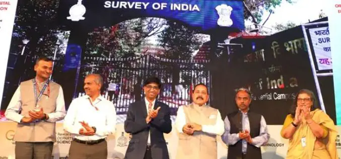
Union Minister Dr. Jitendra Singh Launches CORS Network Operated by Survey of India
In a significant stride towards bolstering India’s geospatial infrastructure, Union Minister Dr. Jitendra Singh inaugurated the nationwide CORS network operated by Survey of India. The cutting-edge initiative, known as the

Bar Charts: The Dos and Don’ts of Designing Effective Visualizations
As data volumes grow, the ability to effectively visualize and convey meaning through graphs and charts has become an essential skill. One of the most versatile means of doing this
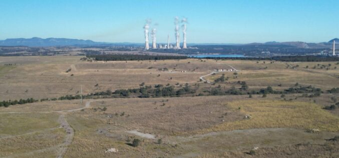
Carbonix, Woolpert Employ Cutting-Edge Drone to Collect Geospatial Data for Coal Mine Rehabilitation
Leading Australian drone manufacturer and solutions provider Carbonix is collaborating with global aerial survey specialist Woolpert to assist with the rehabilitation of one of New South Wales’ oldest open cut

Trimble Launches New IonoGuard Technology to Mitigate Ionospheric Disruptions
Trimble has introduced Trimble IonoGuard™, a next-generation technology designed to mitigate ionospheric disruptions in positioning and navigation by minimizing performance impacts caused by scintillation or signal noise. Referred to as
Effective Water Damage Restoration in Brisbane
Welcome to your comprehensive guide on effective water damage restoration in Brisbane. In the face of harsh climate conditions and unexpected natural disasters, the city records a high frequency of

Mapping Safe Electrical System at Home
Your home is your sanctuary, providing comfort, security, and a space to make memories. An essential yet often overlooked part of this involves the careful planning and installation of an
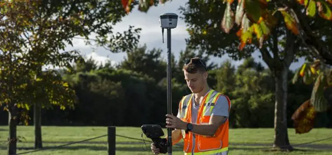
New Trimble R580 GNSS Receiver with Trimble ProPoint Delivers Survey Precision and Productivity in the Field
Trimble R580 Provides Cost-Effective High-Accuracy Reliable Positioning for Geospatial Applications Trimble has recently introduced the new Trimble® R580 Global Navigation Satellite System (GNSS) receiver, the next generation in its portfolio

GEOSAT Announces New Constellation, Reinforcing Its Global Position As A European Operator Of Very High-Resolution Satellites
The Portuguese Earth Observation company, and one of the two European operators of very high-resolution satellites, is starting a new phase of growth for the organization, with the aim of
