
GIS

1Spatial Opens Up Potential Of ArcGIS® Web Mapping For Local Government Via New Subscription Based Licencing Package
New model offers faster, more efficient web mapping with less risk and cost 1Spatial plc, the spatial big data company and the sole distributor for Geocortex in the UK and

OGC and Joint Research Centre to collaborate on standards for geospatial interoperability
19 June 2014. The Open Geospatial Consortium (OGC®) and the European Commission’s Joint Research Centre (JRC) have signed a collaboration agreement to enhance the development and use of geospatial standards.

Global Mapper SDK v15.2 Featuring Updates to Online Data Access
Hallowell, Maine – June 18, 2014 – Blue Marble Geographics (bluemarblegeo.com) is pleased to announce the release of the Global Mapper Software Development Kit (SDK) version 15.2. This interim release features

Caliper Offers Updated Mexico and Brazil Data for Use with Maptitude 2014
NEWTON, MASSACHUSETTS (USA) – Caliper is excited to announce new Brazil andMexico Country Packages! The products include a wealth of data and functionality not available in any other software. Both country packages includes
Esri and RedSeal Bring Geospatial Analysis to Network Security
Redlands, California—Esri and RedSeal Networks are joining forces to create a geospatial framework for cybersecurity. The goal is to fully integrate existing cybersecurity and information technology (IT) data with other
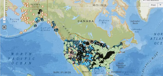
EIA’s U.S. Energy Mapping System is now Accessible on all Mobile Devices
With the 2014 hurricane season now underway, the U.S. Energy Information Administration (EIA) is making it possible for the public to track from all types of mobile devices and tablets

Uttar Pradesh Police to use GIS for Quick Response on Emergencies
In recent news, Uttar Pradesh Police will be using GIS technology to improve the efficiency of emergency emergency response and security surveillance system, in the cities of Allahabad and Ghaziabad,

NIO to so ESI Mapping to Combat Oil Spill
According to recent news, the National Institute of Oceanography (NIO) is doing a pilot study on environmental sensitivity index (ESI) mapping of oil spill to combat and subsequent formation of
Top Companies Showcase Location Analytics at Esri Business Summit
The Wendy’s Company, Miele, and JLL Lead a Powerful Lineup of Businesses Maximizing ROI with the ArcGIS Mapping Platform June 12, 2014 Redlands, California—CIOs, business managers, and IT professionals from

GIS Technology to Build 100 Smart Cities
According to recent news, M Venkaiah Naidu, the new Union Minister for Urban Development and Housing and Poverty Alleviation said that building 100 smart cities in country is the top most priority of
