
GIS

HoloToolKit’s Expanded the Spatial Mapping Capabilities of Microsoft HoloLens
In a recent case study published by Microsoft, Microsoft and Asobo (original code and created a library that encapsulates spatial mapping capability of HoloLens) have now open-sourced this code and made

Kolhapur Municipal Corporation to use GIS for Development Planning
KOLHAPUR, Maharashtra: According to recent news by ToI, the Kolhapur Municipal Corporation (KMC) is planning to harness the power of Geographic Information System (GIS) technology for planning and determining land
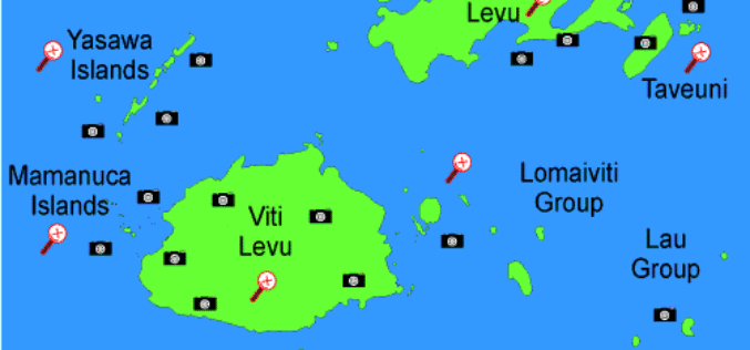
Fiji Launches Geographic Information System to Access Information, Strategic Planning and Crime Mapping
Mr. Faiyaz Koya, Minister for Tourism, Lands and Mineral Resources has recently launched the Vanua Geographic Information System (GIS), is the first of its kind in Fiji – going to

China Made Venezuela and Pakistan Remote Sensing Satellite Launch in 2018
According to recent news by the Business Recorder, China Great Wall Industry Corp, the nation’s only authorized firm for international space collaboration, will launch Venezuela’s second remote sensing satellite next
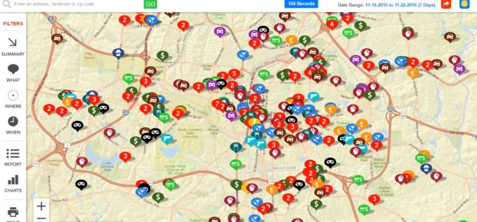
Raleigh Police Department Launches Crime Mapping Tool
Raleigh, North Carolina Nov. 21, 2016- The Raleigh Police Department has launched an online crime-mapping tool that helps people to learn of crimes reported in areas that are of interest to them.

BBMP Planning to Use Total Station for Property Survey
According to recent news by the Deccan Herald, The Bruhat Bengaluru Mahanagara Palike (BBMP) is planning to use Total Station survey to measure big properties, the owners of which may not
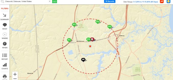
Delaware State Police Announces Crime Mapping Website
Delaware, USA Nov. 17, 2016 – Crime mapping is one tool that serves that purpose and is an extraordinary example of Delaware State Police (DSP) effort to leverage technology to
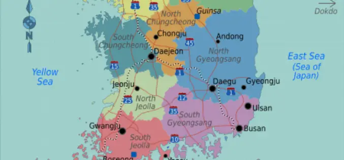
South Korea Refuses Google to Use Official Mapping Data
According to the recent news reported by IANS – South Korea has refused to grant permission to Google to use the official maps of the country, citing security concerns with neighbouring
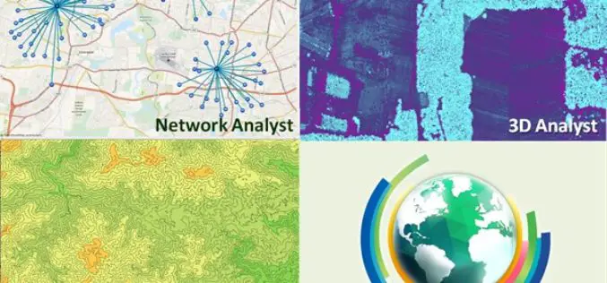
Major Upgrades of SuperGIS Desktop Extensions
The updated version of SuperGIS Desktop was just released this month. In this update, Supergeo not only improved the performance of SuperGIS Desktop 10 but also released multiple latest SuperGIS
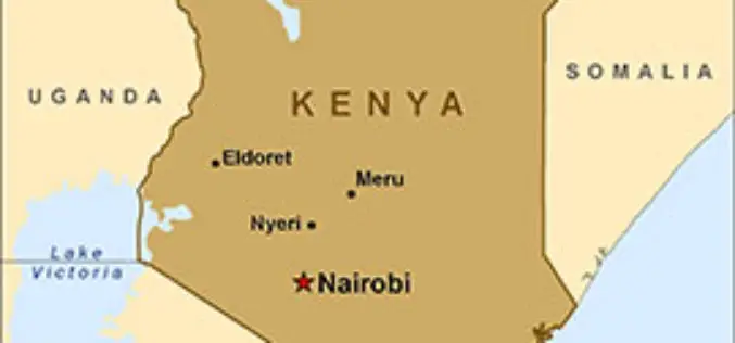
Kenya to Have its First Geospatial Data Centre
According to recent news by IT Web Africa, Kenya could have its its first geospatial data centre by June next year, proposes to cost of Kshs 800 million (US$8m), to
