
GIS
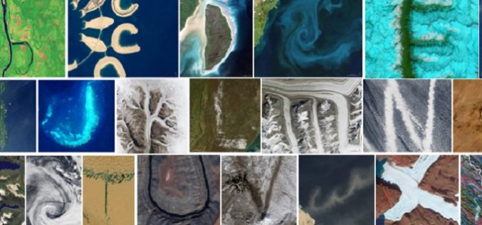
Reading the ABCs from Space
Contributed By:- Space and space-based technologies offer significant and unique solutions to many of real-world problems through remote monitoring and accessing information. Revolution in Earth observations from space has fueled by
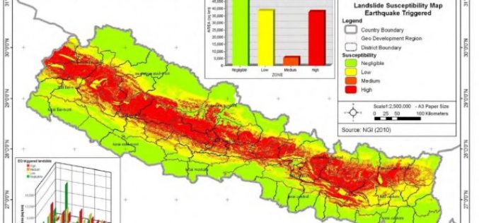
Nepal: Pilot Project on Landslide Hazard Mapping
Kathmandu – According to recent news by The Himalayan Times, the Department of Soil Conservation and Watershed Management, Nepal has started a pilot project of landslide hazard mapping from Dolakha

Bhubaneswar Municipal Corporation to Map Hoardings to Increase Revenue
BHUBANESWAR, Odisha – According to recent news reported by The Time of India, the Bhubaneswar Municipal Corporation (BMC) has decided to bring the locations of all the advertisements or hoardings

Jamaica Acquired Satellite Imagery of the Island to Boost Spatial Data Infrastructure
Jamaica – According to the recent news reported by the Jamaica Observer, the National Spatial Data Management Division (NSDMD) in the Ministry of Economic Growth and Job Creation has informed
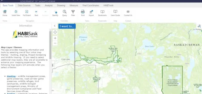
Government of Saskatchewan Launches New Hunting, Angling and Biodiversity Mapping Tool
The Ministry of Environment, Saskatchewan launched a new client-centred, online mapping tool called HABISask (Hunting, Angling and Biodiversity Information of Saskatchewan) that combines new and existing information on hunting, angling,
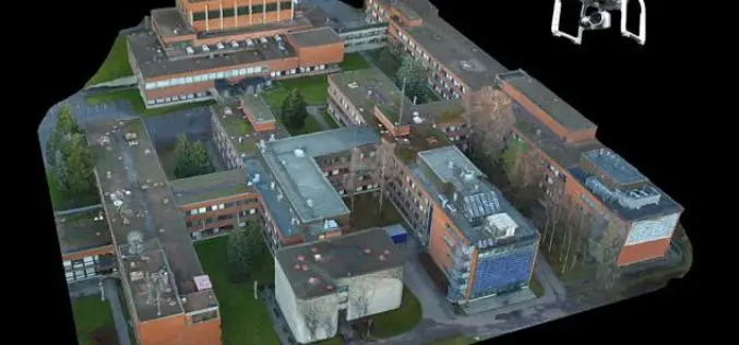
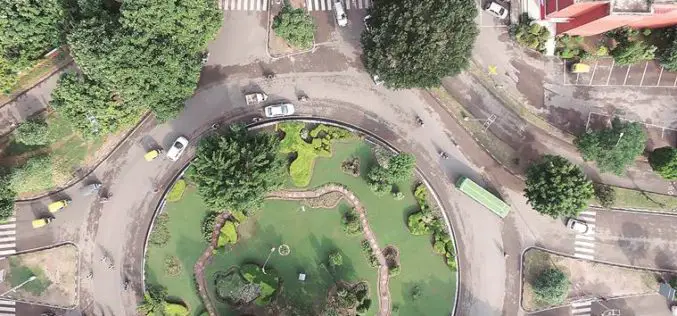
Drone That Can Create a Perfect 3D Map of Any Town – And May Help Set up 5G Networks
London, According to recent news reported by the PTI, Remote-controlled drones can be used to create an accurate 3D model of an urban area and design wireless networks, scientists say,
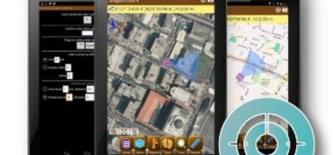
Election Commission of Malaysia Selects SuperSurv for Efficient Spatial Data Collection
Supergeo is delighted to announce that with the assistance from Supergeo’s partner in Malaysia, Suruhanjaya Pilihan Raya Malaysia (SPR Malaysia, lit. Election Commission of Malaysia) has recently chosen SuperSurv 3.3 as the
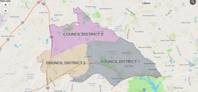
City of Tucker Launches New GIS Platform from InterDev; Debuts Web Application
Tucker, GA and Alpharetta, GA – October 25, 2016 — InterDev, an Atlanta-area provider of information technology, security and geographic information (GIS) services, today announced the City of Tucker has

Sharjah to Conduct GIS Survey of Labour Housing Facilities
According to the recent news, the Sharjah Labour Standards Development Authority (SLSDA) is planning to adopt geographic information system (GIS) and mobile apps to survey labour accommodation in Sharjah. The Sharjah
Central Government Directs Chandigarh to Complete Aerial Mapping Project Within 1 Year
According to recent news by The Indian Express, The Union government on has directed the Chandigarh administration to complete the project of digitization of land records in the city within the
