
GIS
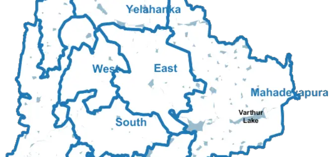
Bengaluru City to Have Geospatial Enabled Property Tax Information System
According to recent news by the Time of India, the online platform for property tax management has been set up by Bruhat Bengaluru Mahanagara Palike (BBMP) in association with the Indian
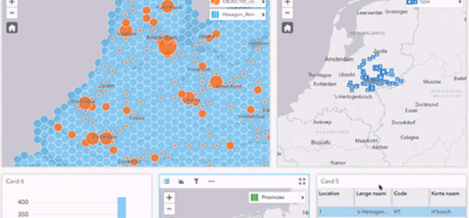
Esri ArcGIS 10.5 Release Transforms Spatial Analytics
Esri has released Esri ArcGIS 10.5 on December 19, the next-generation analytics technology includes the latest release of Esri’s enterprise GIS and unlocks the full potential of your data. Esri

Iran Urges Russia to Start Building Remote Sensing Satellite
The Iranian minister for Communication and Information Technology, Mahmoud Vaezi, urged Russia to start work on constructing the remote sensing satellite both countries agreed upon earlier this year. Speaking in
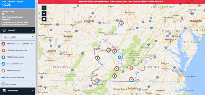
Appalachian Power Launches New Online Power Outage Information Map
CHARLESTON, W.Va., December 16, 2016 – Appalachian Power customers now have access to a new, interactive map that provides real-time information about power outages. Appalachian’s new outage mapping tool makes

ISRO and USGS Signed MoU for Cooperation in Exchange on Remote Sensing Data
New Delhi, (PTI) – A Memorandum of Understanding (MoU) has been signed between Indian Space Research Organisation (ISRO) and United States Geological Survey (USGS) for cooperation in the exchange and
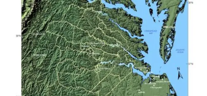
USGS -Building Unified Geospatial Data for Land-Change Modeling—A Case Study in the Area of Richmond, Virginia
Building Unified Geospatial Data for Land-Change Modeling—A Case Study in the Area of Richmond, Virginia Abstract – An effort to build a unified collection of geospatial data for use in
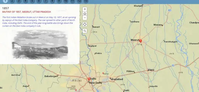
Milestone of Indian Freedom Movements Through Esri Story Map
Contributed By:- The Indian national movement for freedom was undoubtedly one of the biggest mass movements modern society. The movement involved many political and social organizations and armed and unarmed struggle.
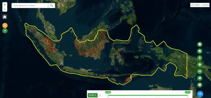
Indonesia Launches Geospatial Portal for Forest Monitoring and Protection
Indonesia – According to recent news by the Eco-Business, the Ministry of Environment and Forestry has launched a new geospatial portal, which will serve as the dedicated and reliable source

Bruhat Bengaluru Mahanagara Palike to Use GIS for Hoarding Management
Bengaluru – According to recent news by The New Indian Express, the Bruhat Bengaluru Mahanagara Palike (BBMP) is planning to take help of the Geographic Information System (GIS) in order
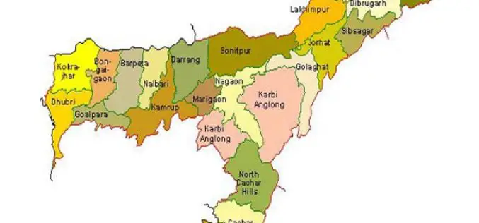
Assam Beings GIS Mapping of Dhubri Town
Assam, India – According to recent news published by The Assam Tribune, the Town and Country Planning (TCP), Dhubri is planning to use GIS for mapping of land parcels in
