
GIS
Habitat Mapping to improve Biodiversity and Crisis Management
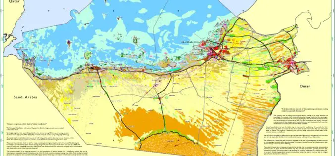
The Environment Agency-Abu Dhabi (EAD) has completed an ambitious project of habitat mapping (terrestrial and marine), landuse and landcover for the Emirate of Abu Dhabi. The mapping of habitats will help

Hyderabad – First City in India to Get Google Street View
The Telangana government has agreed to keep sensitive defence installations in Hyderabad out of Google Street View and the union home ministry is expected to soon give permission for the
Who Else Want to See World in 3D
Vricon, developed as a joint venture of Saab and DigitalGlobe, Inc., is to produce data rich 3D model of world. DigitalGlobe and Saab will combine their strengths to both support and own Vricon. Saab will

FEMA Release Guidelines for Coastal Flood Hazard Analysis and Mapping
The U.S. Federal Emergency Management Agency has issued Guidelines for Coastal Flood Hazard Analysis and Mapping for the Pacific Coast of the United States. FEMA’s mission is to support citizens and
EPA has Launched Environmental Mapping Tool
United States Environmental Protection Agency (EPA) has launched a new environmental justice (EJ) mapping and screening tool called EJSCREEN. It is based on nationally consistent data and an approach that

Michigan Launch Portal for Free Geospatial Data
State of Michigan has launched a portal for citizens to access and download free geospatial data about their state. The data is available for government, business and public use, with
FOSS4G Europe Annonce Conference Program
The second edition of the FOSS4G Europe Conference will be held at Politecnico di Milano in Como, Italy, from July 15th to 17th, 2015. A day of workshops will precede
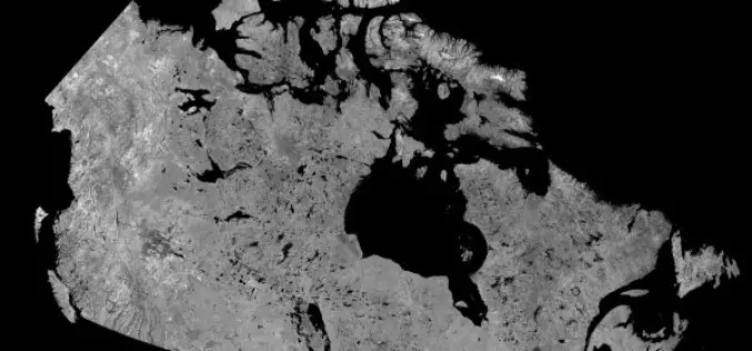
Download Free RADARSAT Data of Canada
Canada’s RADARSAT-1 is a radar satellite and was launched in November 1995. It carries a Synthetic Aperture Radar (SAR), it acquired images of the Earth day or night, in all

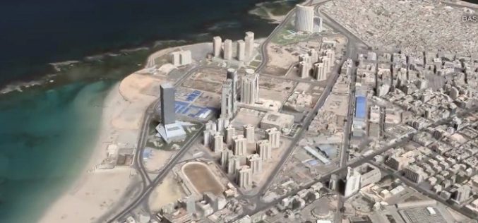
3D Mapping of Heritage Monuments for Tourism Promotion
According to recent news from ToI, the tourism department of Telangana state is going for 3D mapping of heritage monuments and buildings of city. Hyderabad city has many heritage monuments

Leica Introduce Leica Pegasus: Backpack Industry First Wearable Reality Capture
Leica Geosystems announced the commercial availability of Leica Pegasus: Backpack this week at HxGN LIVE. Leica Pegasus: Backpack is first of its kind in geospatial industry. It comes with a
