
GIS
ISPRS Releases The International Archives of the Photogrammetry, Remote Sensing and Spatial Information Sciences
The International Archives of the Photogrammetry, Remote Sensing and Spatial Information Sciences is the series of proceedings published by the International Society of Photogrammetry and Remote Sensing (ISPRS). The Archives
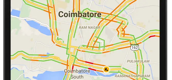
12 Cities in India to Get Live Traffic Updates Through Google Map
Never miss your flight or train, use Google Map to get real time traffic updates to route your drive around the traffic and save your time. Google has launched the

Google Maps Will Soon Alert Drivers about Railroad Crossings
According to The New York Times, the Federal Railroad Administration, United States of America and Google have agreed to update its maps with crossing locations. The new maps will ensure

Amazon Web Services – City on a Cloud Innovation Challenge 2015
Amazon Web Services simplifies IT workloads that governments struggle with every day, making it easier to deploy and manage the technology our customers depend on, such as Geographical Information Systems
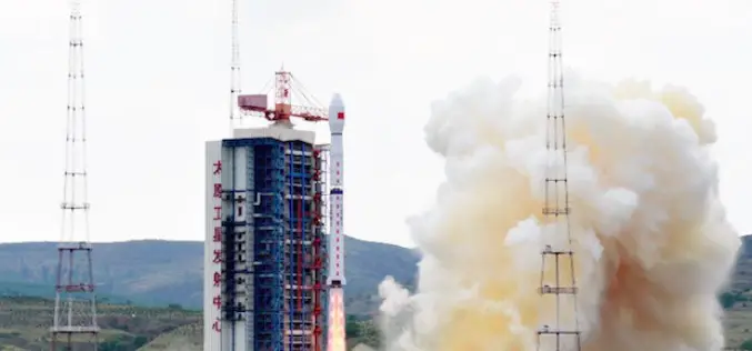
China Launches Gaofen 8 Earth Observation Satellite
In recent news, China has successfully launched the Gaofen 8, a high resolution optical remote sensing satellite into a scheduled near-circular orbit with an average altitude of around 473 kilometers, or
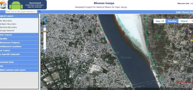
Pollution Monitoring of River Ganga Using Geospatial and Crowd-Sourcing Technologies
As reported by Business Standard, the Government of India’s flagship Clean Ganga Mission, National Mission for Clean Ganga (NMCG), Ministry of Water Resources, River Development and Ganga Rejuvenation and National
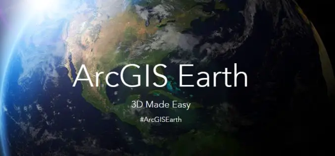
ArcGIS Earth, A Free and New Tool to Analyze 2D and 3D Data
Esri is planning to launch a new tool “ArcGIS Earth”, a freely available, lightweight, installable desktop app that makes viewing 3D maps instant and easy for anyone in the enterprise. ArcGIS Earth
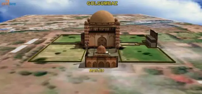
ISRO to Map and Create 3D Modelling of National Heritage Sites
Ministry of Culture, Government of India and Indian Space Research Organisation (ISRO) has collaborated to start a national project for inventory and monitoring of archaeological sites of the country. The

A New Era of Space Collaboration between Australia and U.S.
On June 18, 2015 in Canberra, Australia, the U.S. Geological Survey and Geoscience Australia signed a comprehensive new partnership to maximize land remote sensing operations and data that can help

Mount Everest Moved 3 cm, Height Not Affected By Nepal Earthquakes
Beijing: Mount Everest moved three cms during the recent devastating earthquakes in Nepal but contrary to earlier reports the height of world’s tallest mountain has not been affected, Chinese official monitoring
