
Business
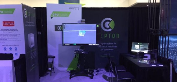
Cepton Launches its High-Performance LiDAR Solutions
Next-generation optical sensors deliver perception to smart machines with unrivaled resolution and cost May 09, 2017 – SAN JOSE, Calif.–(BUSINESS WIRE)–Cepton Technologies, Inc., a provider of 3D sensing solutions for automotive
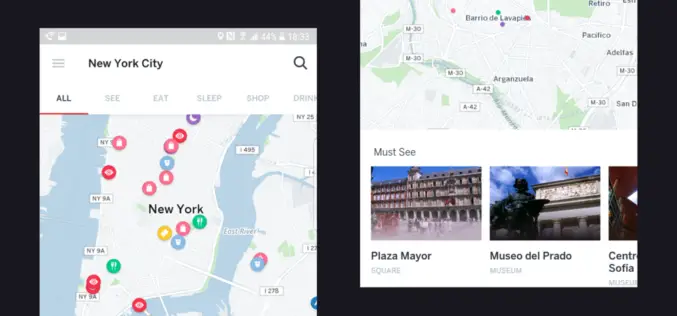
CARTO Delivers Most Advanced Offline Maps with New Mobile SDK for Android & IoS
Users can develop custom mobile apps with native offline mapping, location data services, and the analytical power of location intelligence New York, New York – May 09, 2017 – CARTO, the

OGC invites you to its Environmental Linked Feature Interoperability Experiment: ELFIE
Monday, 8 May 2017 UTC – The Open Geospatial Consortium (OGC®) invites interested members & non-members alike to participate in the OGC Environmental Linked Feature Interoperability Experiment (ELFIE). In recent years,

PrecisionHawk Launches Free PrecisionMapper Software for Drone Mapping
Now drone operators can stitch an unlimited number of photos, create maps without resolution limits and run algorithms to analyze their data for free PrecisionHawk, a leading commercial drone and

senseFly Corridor Solution Boosts Efficiency of Linear Mapping Projects
Today’s new combined hardware/software release makes assessing linear assets with UAS easier and less data-intensive than ever before senseFly, the world’s leading producer of mapping drones, today announces senseFly Corridor,
Global Mapper and Geographic Calculator Free Academic License Program is Now Live
Hallowell, Maine – May 2, 2017 – Blue Marble Geographics (www.bluemarblegeo.com) is pleased to announce the launch of its new academic licensing program with a new web page now available
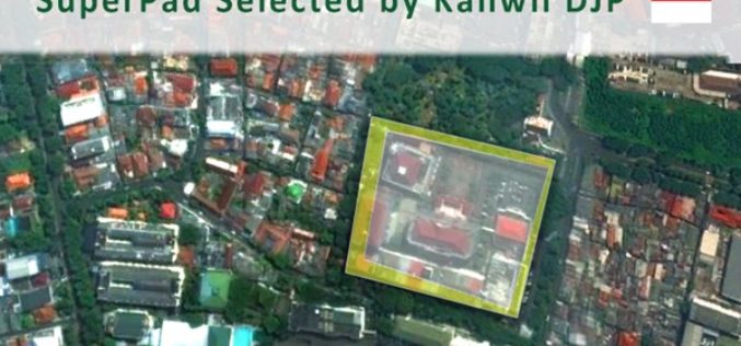
Taxation Authority in Indonesia Selects SuperPad 3.3 to Collect Data
With the assistance of Supergeo’s partner in Indonesia, DataScrip, the regional offices of Indonesian taxation authority recently selected SuperPad 3.3 as the mobile GIS software for spatial data collection. Under

SuperSurv Selected by Agricultural Company Socfinco
The global GIS software provider Supergeo Technologies Inc. is delighted to announce that its cutting-edge mobile GIS software SuperSurv has been chosen by Socfinco, the agricultural company. Located in Brussels,
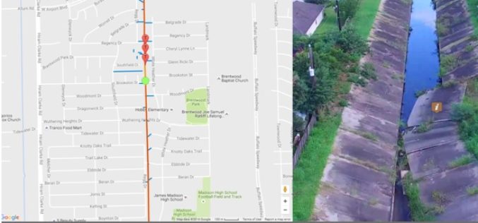
Georeferenced Video, an Alternative to Aerial Photogrammetry
Contributed By:- According to the Texas Comptroller, the state of Texas spends nearly $6 million per year on public infrastructure, including highways and other repairs and maintenance activities. Local spending
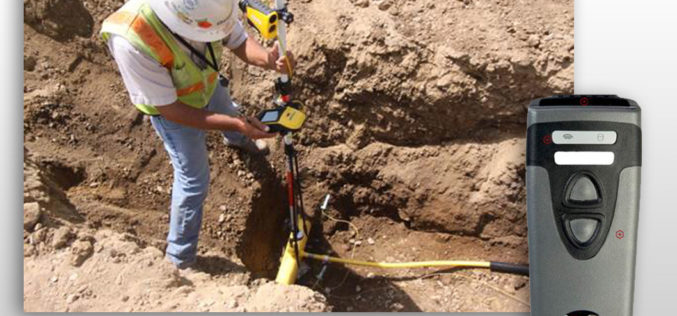
CartoPac Unveils Barcode Scanner Solution for Gas Utility Pipeline Mapping
CartoPac Unveils Barcode Scanner Solution for Gas Utility Pipeline Mapping Integrated Hardware, Software Included FORT COLLINS, Colorado, USA, 27 April 2017 – CartoPac International Inc., an enterprise mobile software and
