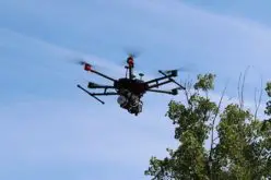
 Montreal, Canada, March 21st, 2017 – SimActive Inc., a world-leading developer of photogrammetry software, is pleased to announce a fully-integrated solution with Tianlifa, a major firm in the Asian surveying market for over 20 years. The partnership results in a high-end mapping product featuring the new China Star drone from Tianlifa and SimActive’s Correlator3D™.
“We wanted the best available software for the significantly higher quality of sensors and stability offered by the China Star,” said Mr Shutian Zhao, Group Chairman of Tianlifa. “SimActive offers pioneering, scalable technology, making them the ideal fit for our exponential drone sales.”
“With twice the average flight time, the China Star drone offers increased autonomy and robustness,” said Dr Philippe Simard, President of SimActive. “Tianlifa’s industry expertise paired with our software will give customers an incomparable cartography experience.”
For a live demonstration at Japan Drone (March 23-25, Chiba, Japan), please visit SimActive’s booth or send an email to sales@simactive.com.
To see the latest version of Correlator3D™ on March 28th, 2017, 10:00 AM Eastern Time, please sign up for the next Webinar here.
About Tianlifa
Beijing Tianlifa Science & Trade Co. provides advanced equipment and measuring system solutions for the surveying, mapping and geographic information industry since 1996. The company offers R&D, manufacturing, sales, testing and after-sale services of surveying instruments and software. Based in Beijing, Tianlifa has branch offices in Tianjin, Shijiazhuang, Tai yuan, Hohhot, Shenyang, Changchun, Changsha, Chengdu, Nanchang, Hefei, Guangzhou and Xi’an as well as distribution partners and sales service centers across provinces and cities of China. For more information, visit www.tianlifa.com.
About SimActive
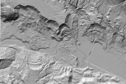
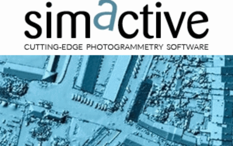
SimActive is the developer of Correlator3D™ software, a patented end-to-end photogrammetry solution for the generation of high-quality geospatial data from satellite and aerial imagery, including UAVs. Correlator3D™ performs aerial triangulation (AT) and produces dense digital surface models (DSM), digital terrain models (DTM), point clouds, orthomosaics and vectorized 3D features. Powered by GPU technology and multi-core CPUs, Correlator3D™ ensures matchless processing speed to support rapid production of large datasets. SimActive has been selling Correlator3D™ to leading mapping firms and government organizations around the world, offering cutting-edge photogrammetry software backed by exceptional customer support. For more information, visit www.simactive.com.