
Business
Microsatellites, Megaconstellations and Strategies for Combatting Increasing Volumes of Space Debris
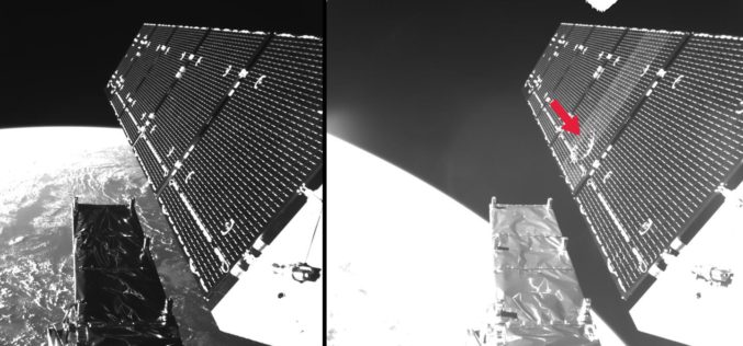
7th European Conference on Space Debris in Darmstadt from 18 to 21 April Microsatellites, mega constellations, and strategies for combatting increasing volumes of space debris Approximately 350 scientists, engineers, managers

Global Push for Earth Observations Continues
The Group on Earth Observations (GEO) has been working for more than a decade to open access to Earth observation data and information, and increase awareness around their socioeconomic value.
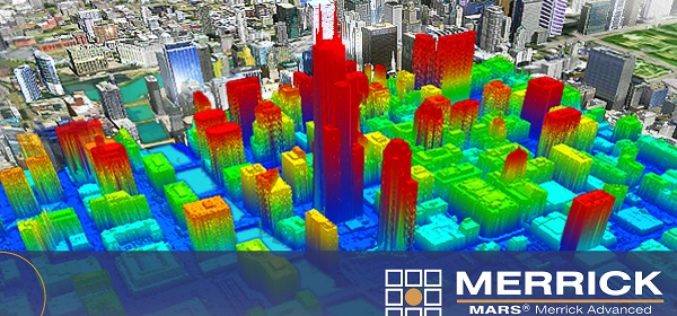
Merrick Releases MARS® 2017 Software Suite
Merrick & Company, a global leader in light detection and ranging (LiDAR), digital orthophotography, hyperspectral imaging, and geographic information systems (GIS) data integration, is pleased to announce the release of
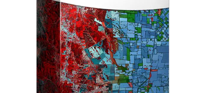
PCI Geomatics Releases Geomatica 2017, Featuring Geomatica Object Analyst and Geomatica InSAR Modules
MARKHAM, Ontario, Canada — April 11, 2017: PCI Geomatics, a world leading developer of remote sensing and photogrammetric software and systems, announced today the release of Geomatica 2017 – the
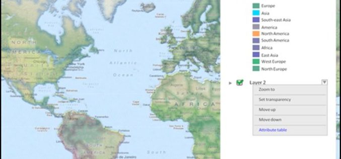
Towards a More Integrated Web GIS Solution – SuperGIS Server 10
When your company grows bigger as the project scale becomes larger, to organize huge volume of data wisely turns to be increasingly important. Based on the abundant experience of developing

Next SuperSurv 10 Release Will Add Powerful Features
Equipped with advanced GIS and GNSS technologies, SuperSurv 10 is a cutting-edge mobile GIS app that operates on Android OS. After installing SuperSurv 10, field surveyors only need to bring
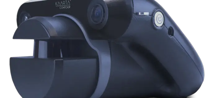
KAARTA Alters the Course of 3D Modeling With Launch of Contour
The first-of-its-kind device condenses 3D modeling to one product, one step, in real time Houston, TX-April 3, 2017 – Kaarta, innovator of the next big leap in 3D modeling, brings an
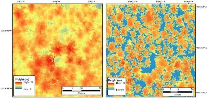
Bluesky LiDAR Maps Used to Monitor the Spread of Deadly Tree Disease
Laser maps collected by airborne mounted sensors have, for the first time, been used to successfully segment individual trees affected by the deadly Larch tree disease. The laser scanning surveys
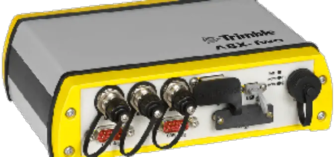
Trimble Introduces Compact, High-Performance OEM GNSS Sensor for System Integrators
SOUTHAMPTON, United Kingdom, April 6, 2017—Trimble (NASDAQ:TRMB) introduced today the Trimble® ABX-Two OEM GNSS sensor. The ABX-Two delivers precise heading, pitch, roll and 3D positioning information. With two internal MB-Two

Blue Marble Offers Free Access to Global Mapper and Geographic Calculator at Higher Education Schools in the U.S. and Canada
Hallowell, Maine – April 4, 2017 – Blue Marble Geographics (bluemarblegeo.com) is pleased to announce that institutes of higher education in the U.S. and Canada will shortly be granted free
