
Business
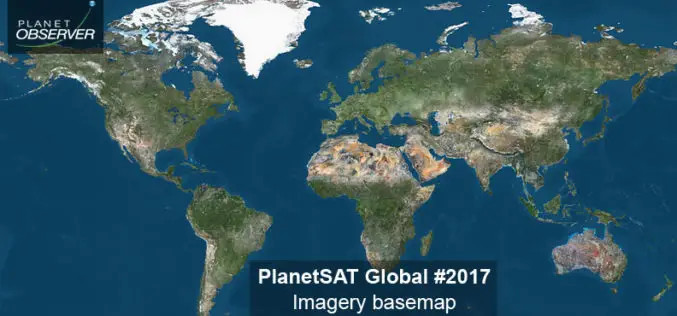
PlanetObserver Announces Release of PlanetSAT Global Imagery Basemap Version #2017
Clermont-Ferrand, France – 26 April 2017 – The French company PlanetObserver, supplier of geospatial data for all civil and military visualization and simulation applications, and GIS solutions, announces the release

Centrik Collaborates with AviComply to Support RPAS Operators Across South Africa
Centrik, the management system for Remotely Piloted Aircraft Systems (RPAS) is set to dramatically simplify RPAS compliance and operational management in South Africa through a new strategic alliance with AviComply.

Smart Cartography: “Six Examples of How Old-fashioned Navigation Aids Have Been Transformed into Today’s Smart Maps”
SMART CARTOGRAPHY: Six examples of how old-fashioned navigation aids have been transformed into today’s smart maps Berlin, Germany 25, April 2017 | The 65th Cartography Conference run by the German Society
East View Geospatial Announces Training Data Library for Geospatial Machine Learning
MINNETONKA, Minnesota, USA, 24 April 2017 – East View Geospatial (EVG), a provider of content-rich cartographic products, is building a library of highly accurate geospatial training data for use in

OGC seeks public comment on candidate OGC Web Coverage Service 2.0 Interface Standard – Earth Observation Application Profile 1.1
The Open Geospatial Consortium (OGC®) is seeking public comment on its Web Coverage Service 2.0 Interface Standard – Earth Observation Application Profile 1.1. This OGC WCS Application Profile – Earth

Humanitarian Technology: High-tech for Relief Workers
DLR supports the United Nations World Food Programme (WFP) through satellite-based risk mapping DLR supports the UN World Food Programme (WFP) in a special calendar to identify environmental risks recurring

Space Flight Laboratory (SFL) to Discuss Successful Remote Sensing SmallSat Missions at IAA Berlin
TORONTO, Ontario, Canada, 19 April 2017 – Space Flight Laboratory (SFL), a provider of complete microspace missions, will present papers on the successful GHGSat-D greenhouse gas monitoring and CanX-7 aircraft

MapmyIndia builds first Digital Map Twin of Real World
MapmyIndia builds first Digital Map Twin of Real World , releases intelligent, multi-lingual ‘Hey Map’ keyboard app with map and eLoc integrated, and announces ISRO, Idea Cellular and more Make

Trumbull Unmanned Using SimActive for Emergency Response
Montreal, Canada, April 18th, 2017 – SimActive Inc., a world-leading developer of photogrammetry software, is pleased to announce that Trumbull Unmanned is using Correlator3D™ as part of their emergency response

KARI and SIIS Announce Starting KOMPSAT DRS (Direct Receiving Station) Service in DLR
KARI (Korea Aerospace Research Institute, www.kari.re.kr) and SIIS (SI Imaging Services, www.si-imaging.com) are very pleased to announce that on April 1, we began to offer KOMPSAT (Korean Multi-Purpose Satellite) DRS
