CLC+ Backbone Raster Product Updates for the Reference Years 2023 and 2025 Awarded
The European Environment Agency (EEA) has awarded an international consortium led by GAF AG with partners GeoVille, e-GEOS and Telespazio Ibérica, with the production of the updates of the CLC+ Backbone Raster Product for the years 2023 and 2025 as part of the Copernicus Land Monitoring Service (CLMS).
A consortium led by GAF AG with partners GeoVille, e-GEOS and Telespazio Ibérica has been awarded by the European Environment Agency (EEA) with the implementation of the upcoming updates of the Copernicus Land Monitoring Service (CLMS) flagship project of the CLC+ Backbone (BB) for the years 2023 and 2025.
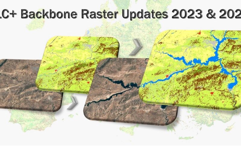
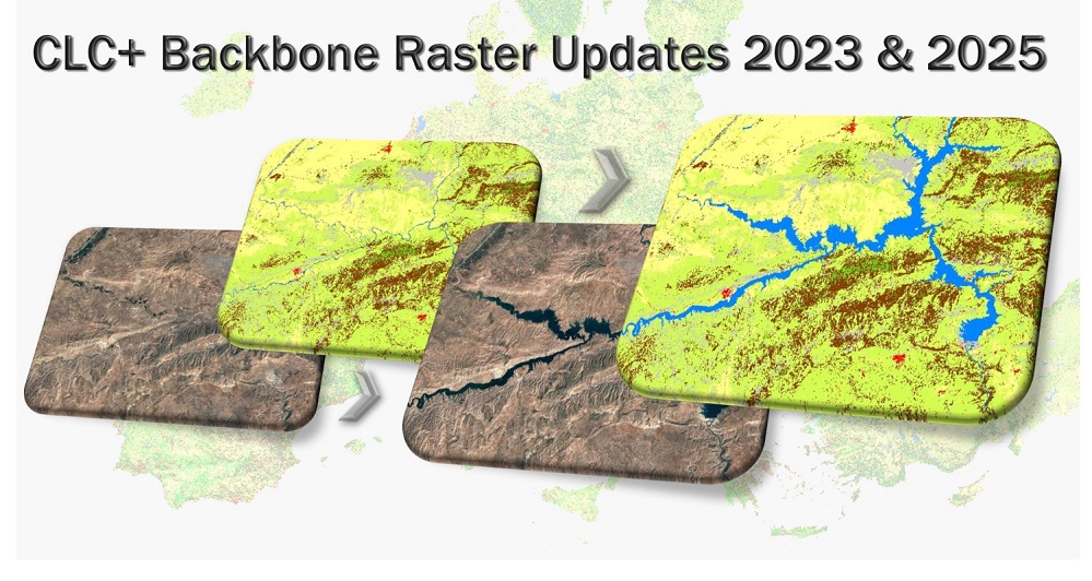
The CLC+ BB Raster Product is a land cover classification at 10m spatial resolution, produced from Sentinel-2 time series data and covering the area of the EEA38 countries.
It provides wall-to-wall land cover information based on an 11-class nomenclature and with a very high thematic accuracy of > 90%. The two updates to be produced in this newly awarded contract will continue the existing product time series for 2018 and 2021 with the reference years 2023 and 2025, thus moving the product line to a bi-yearly update cycle, providing users with access to a consistent time series of detailed information on land cover.
This serves a wide range of applications such as environmental monitoring, land use planning, climate change-related assessments, and emergency management. CLC+ Backbone is currently being used to support the implementation of the Regulation on the Inclusion of Greenhouse Gas emissions and Removals from Land use, Land Use Change and Forestry (LULUCF) and can also contribute to the implementation of various European environmental policies related to the Green Deal.
The consortium unites extensive experience in large scale operational land cover mapping and cloud processing, gained from various Copernicus projects (among others), and has already carried out the previous CLC+ BB Raster Productions for 2018 and 2021. The Raster Product updates will be produced in a cloud-based environment, utilizing up to date machine learning technologies, enabling high production efficiency.
The production of the 2023 reference year will start in January 2024 and the final product is expected to be available in the fourth quarter of 2024. The subsequent production of the reference year 2025 will take place in 2026.
About GAF AG
GAF AG, an e-GEOS (Telespazio/ASI) company based in Munich and Neustrelitz, was founded in Munich in 1985 as the first German company with a focus on applied remote sensing. It is one of the leading commercial geoinformation service providers in Europe. As part of the GEOS/Telespazio group of companies, GAF offers an extensive service portfolio that, in addition to the direct reception and distribution of satellite data, also includes highly developed analysis techniques, AI processes and the tailor-made development of geoinformation and software systems and platforms as well as consulting solutions. Its areas of thematic expertise for public and private clients worldwide include land monitoring, natural resource management, water and environmental monitoring, agriculture and forestry, mining, emergency management and infrastructure security. GAF is also one of the most experienced European service providers in the EU/ESA Copernicus programme, due to its many years of service implementation for the Copernicus land monitoring service, emergency management service and security and in-situ service components.