From imagery to impact: how high-resolution aerial data transformed water sustainability efforts in Southern California
Authored by- Hexagon
In Southern California, water scarcity is a critical issue. Due to periodic droughts and the growing impacts of climate change, the region faces urgent challenges when it comes to managing its limited water resources.
The Rancho California Water District (Rancho Water) serves more than 150,000 residents across a vast 100,000-acre area. Located southeast of Los Angeles, the district provides water and wastewater services via 39 reservoirs, sourcing supplies from natural and treatment facilities. Faced with such a large and diverse service area, Rancho Water is tasked with optimising water use and promoting sustainability through innovative technological solutions.
One of the district’s key initiatives has been identifying and mapping land cover types to optimise water usage, especially in residential areas where turf and landscaping can account for a large portion of water consumption. To meet regulatory requirements and ensure efficient water distribution, Rancho Water collaborated with DCSE Inc., a consultancy with expertise in GIS engineering and resale partner of Hexagon’s HxGN Content Program, to carry out a comprehensive project aimed at improving water conservation in the region.
Saving water against regulatory pressures
California’s droughts and the growing impact of climate change have brought stricter regulations for water conservation. Rancho California Water District (Rancho Water) needed to comply with rules set by the California Department of Water Resources (DWR), particularly focusing on ‘non-functional’ turf – decorative grass in areas like medians and plazas that have no practical use. Under state law, these areas cannot be watered with potable water, even outside of drought periods.
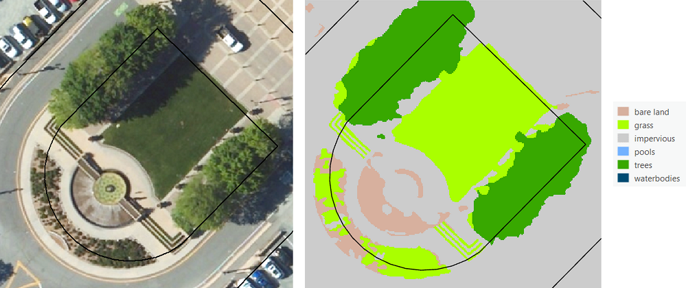
In 2023, Rancho Water wanted to identify non-functional turf areas within its 100,000-acre service area, classify land cover types across individual parcels, and assess the water needs associated with various landscaping features. There were two key goals: to ensure compliance with state conservation mandates and to support the district’s Turf Replacement Programme, which incentivises homeowners to replace water-intensive grass with drought-resistant plants.
Using aerial imagery to classify land cover
Traditionally, aerial imagery has been used to classify land cover types, but the resolution and accuracy of the data play a critical role in the success of such projects. Initially, DCSE used free imagery from the U.S. Department of Agriculture, which had a spatial resolution of 60 centimetres (cm). This accurately classified land types by 94%, on average.

However, this resolution caused issues when distinguishing between turf and trees. The similar image signatures of healthy grass and trees meant that they were misclassified at a rate of up to 15%. These results are okay for some applications – combining irrigated turf and trees into one class is actually acceptable for DWR requirements. However, Rancho Water required a higher level of precision because, to them and their residents, every drop of water matters.
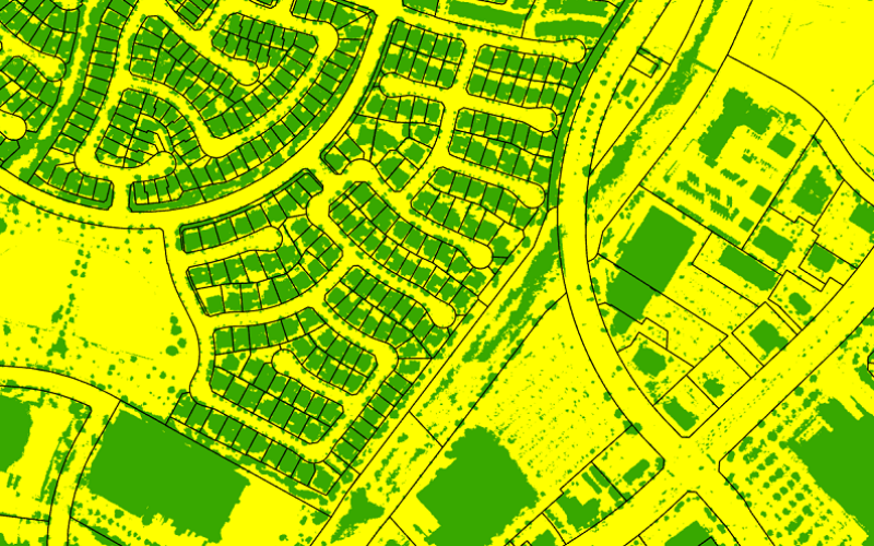
To address this challenge, DCSE turned to Hexagon’s high-resolution aerial imagery from the Hexagon Content Program – an expansive database of high-resolution aerial imagery, elevation data, 3D models and analytics across the United States and Western Europe. With imagery offering a resolution of 15 cm, as well as elevation data from a digital surface model (DSM), the team was able to significantly improve the accuracy of the classifications. The 15 cm imagery allowed the team to better distinguish between turf and trees, with a classification accuracy exceeding 96%. Moreover, the DSM data enabled them to apply a height filter, further refining the analysis.

Enhanced accuracy with high-resolution data
This improved level of precision was essential for Rancho Water, as it allowed the district to make more informed decisions regarding water usage, turf replacement, and compliance with regulations.
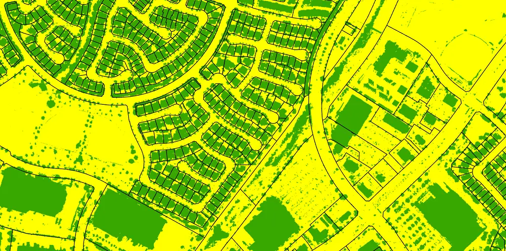
By combining spectral data with height information, the model could separate tree canopies from turf, allowing the district to identify which areas could be included in turf replacement programmes and which required special attention due to non-functional turf regulations.
The GIS coordinator at Rancho Water, Liviu Rosu, said “The accurate classifications and measurements provided by Hexagon’s high-resolution imagery and elevation data enable districts to fulfil state mandates while also delivering fair and equitable services to our water users.”
Supporting water conservation and decision-making
The data collected and processed through these measures provides Rancho Water with actionable insights that support better decision-making for water management. By identifying non-functional turf and classifying land cover accurately, the district can optimise irrigation practices, manage water use more efficiently, and engage with homeowners to reduce water consumption.
“The accurate classifications and measurements provided by Hexagon’s high-resolution imagery and elevation data enable districts to fulfill state mandates while also delivering fair and equitable services to our water users,” said Liviu Rosu, GIS Coordinator at Rancho Water.
Through the integration of Hexagon’s high-resolution aerial imagery and DSM data, Rancho Water is making strides in its water conservation efforts. With the new insights provided by DCSE and Hexagon, the district is not only complying with state regulations but also paving the way for more sustainable and efficient water management throughout Southern California.
Tackling drought with aerial sensors
Water sustainability is a crucial issue. By leveraging high-resolution imagery, LiDAR technology, and advanced data analysis, organisations like Rancho Water can make smarter, more informed decisions to improve water usage. High-resolution aerial imagery and elevation data will continue to play a vital role in supporting these efforts, especially with the development of hybrid sensors that can capture multiple data types at once. These will help towns and cities navigate the challenges posed by drought and climate change.


