When building up a web map platform, it is crucial for developers to be able to control all the GIS layers. With the latest release of SuperGIS Server JavaScript APIs, developers are now able to gain a fine grain control to their data, including integrating, managing, and displaying.
Integrate GIS Layers
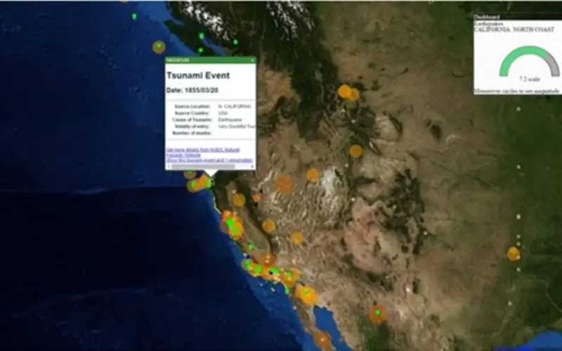
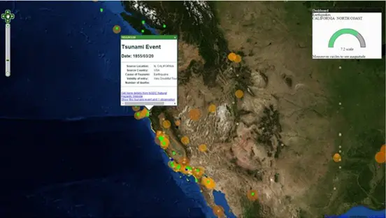
Now developers are able to integrate various kinds of GIS layers online, including kml, csv, WMS, WMTS, GeoJSON. All these different formats can be integrated together and used to derive even more information. For example, the following website integrates tsunamis (kml layer), earthquakes (csv layer), and city vulnerabilities (WMS layer).
http://sgs.supergeo.com.tw/city/webinarkml.htm
Manage Layers
With the latest editing tool and attribute inspector, users now can edit geometries and attributes more easily. The new editing tool allows users to edit vertexes and rotate, scale, or delete geometries. And the attribute inspector provides a user-friendly interface to update the attribute values.
Display Layers
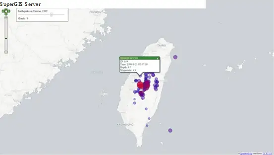
The powerful JavaScript renderers allow developers to flexibly display the layers. For example, the following website uses a temporal slider to show the temporal dimension of your data, and render data with different size, color, and opacity based on their attributes.
http://sgs.supergeo.com.tw/Time/SampleTimeFilter.htm
The latest JavaScript API will be released with SuperGIS Server 3.2.0010, which will be launched at the end of this month. Now you can go to SGDN and learn more about the new API and get ready for the new update!
SGDN: http://sgdn.supergeotek.com/supergis_server_api_JavaScript.aspx