Geospatial Technologies for Wildlife Conservation underscores the urgency of wildlife conservation, which has never been more pressing. With rapid habitat loss, climate change, and increased poaching, numerous species face the threat of extinction. The decline in biodiversity not only disrupts ecosystems but also poses a threat to human well-being, as it affects ecosystem services that we rely on.
Geospatial technology has emerged as a vital tool in the fight to conserve wildlife. This technology, which includes GPS, GIS, remote sensing, and drones, plays a crucial role in modern conservation efforts by providing precise data and real-time monitoring capabilities. Understanding and utilizing these technologies is essential for effective wildlife conservation strategies.
Geospatial Technologies for Wildlife Conservation
Geospatial technology encompasses a range of tools that are essential for wildlife conservation:
- GPS (Global Positioning System): GPS technology is widely used for tracking animal movements and migrations. Devices such as tracking collars fitted with GPS units provide data on animal locations, helping researchers monitor their patterns and behaviors. These devices can transmit real-time data to conservationists, allowing for immediate action if an animal is in danger.
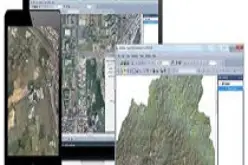
- GIS (Geographic Information Systems): GIS is a powerful tool for mapping and analyzing spatial data. It allows conservationists to visualize habitats, assess environmental impacts, and plan conservation strategies effectively. GIS can integrate various data types, such as satellite imagery, field observations, and statistical data, to create comprehensive maps that highlight critical habitats and areas of concern.
- Remote Sensing: This technology involves collecting data from satellites or aircraft to monitor changes in the environment. Satellite imagery from sources like Landsat and Sentinel provides valuable information on habitat conditions and changes over time. Remote sensing can detect changes in vegetation cover, water bodies, and land use, which are crucial for understanding habitat dynamics.
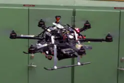
- Drones: Drones offer a bird’s-eye view of wildlife habitats and can cover large areas quickly. They are used for aerial surveys, monitoring animal populations, and even detecting poaching activities. Drones equipped with thermal cameras can detect animals in dense forests or at night, providing data that is otherwise difficult to obtain.
- Software for Data Processing and Mapping: Tools such as ArcGIS, QGIS, and ENVI are used for processing and analyzing spatial data. These software platforms allow for the integration and visualization of various data sources, aiding in the development of detailed conservation plans. Machine learning algorithms can be applied to this data to identify patterns and predict future changes.
Applications of Geospatial Technologies in Wildlife Conservation
Geospatial technology has diverse applications in wildlife conservation:
- Real-Time Tracking and Monitoring: GPS collars and tags allow for the real-time tracking of animals, providing critical data on their movements and behaviours. This information is essential for understanding migration patterns and identifying critical habitats. For example, tracking the migration of elephants in Africa helps in creating wildlife corridors that facilitate safe passage.
- Habitat Analysis and Environmental Impact Assessments: GIS and remote sensing tools are used to analyze habitats and assess the impact of environmental changes. This helps in identifying areas that need protection and in planning restoration projects. Remote sensing data can reveal deforestation rates, water availability, and changes in land use, which are vital for habitat conservation.
- Anti-Poaching Surveillance and Intervention: Drones and remote sensing are instrumental in detecting and preventing poaching. By monitoring vast areas, these tools help law enforcement agencies respond swiftly to illegal activities. Thermal imaging drones can detect poachers at night, while satellite imagery can identify suspicious activities in remote areas.
- Monitoring Species Populations and Migrations: Geospatial technology enables the monitoring of species populations, helping conservationists track changes and assess the health of wildlife populations. This is crucial for species like the snow leopard in the Himalayas, where rugged terrain makes traditional monitoring difficult.
- Identifying and Protecting Critical Habitats: GIS and remote sensing are used to identify critical habitats that are essential for the survival of endangered species. Protecting these areas is crucial for biodiversity conservation. For instance, identifying and protecting wetlands is vital for the survival of migratory birds.
Case Studies on Wildlife Conservations
Numerous successful conservation efforts have leveraged geospatial technology. Here are detailed case studies that illustrate the impact of these technologies:
Hyderabad, India: Tech-Driven Wildlife Conservation
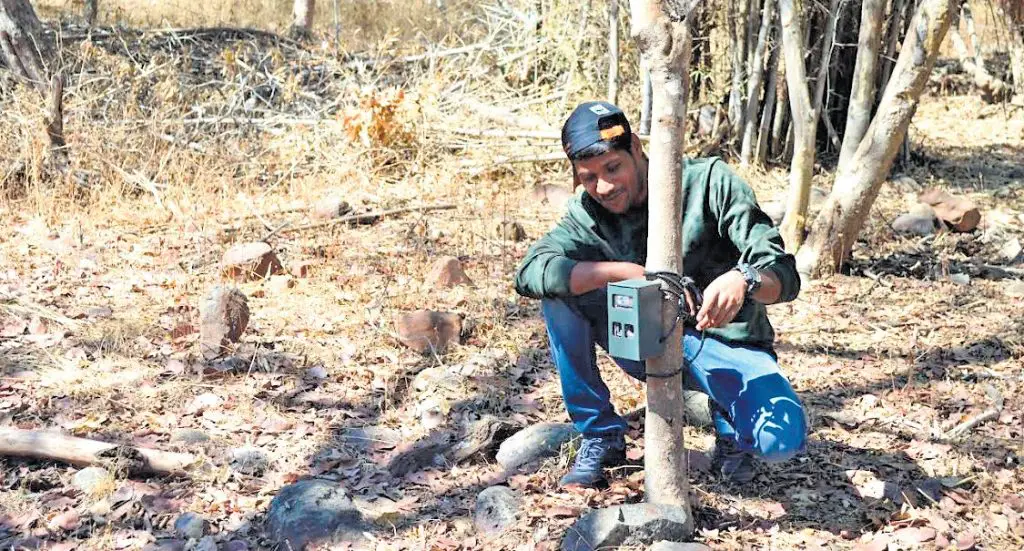
In Hyderabad, a tech-driven wildlife conservation initiative employs drones and GIS to monitor and protect wildlife. Drones equipped with high-resolution cameras and thermal imaging sensors are used to conduct aerial surveys and monitor wildlife activities. GIS software is used to analyze the collected data, identify poaching hotspots, and plan patrol routes. This project has seen significant success in reducing poaching and preserving habitats, with a notable increase in wildlife sightings and reduced incidents of illegal activities.
Kerala, India: Wild Elephant Census
Kerala’s wild elephant census utilizes GPS and remote sensing to ensure accurate population counts and habitat assessments. GPS collars are placed on selected elephants to track their movements and gather data on their range and behaviour. Remote sensing data from satellites is used to analyze habitat conditions and changes over time. The methodology includes integrating field observations with satellite data to improve accuracy. The results have highlighted critical corridors and habitats that need protection, leading to better conservation strategies.
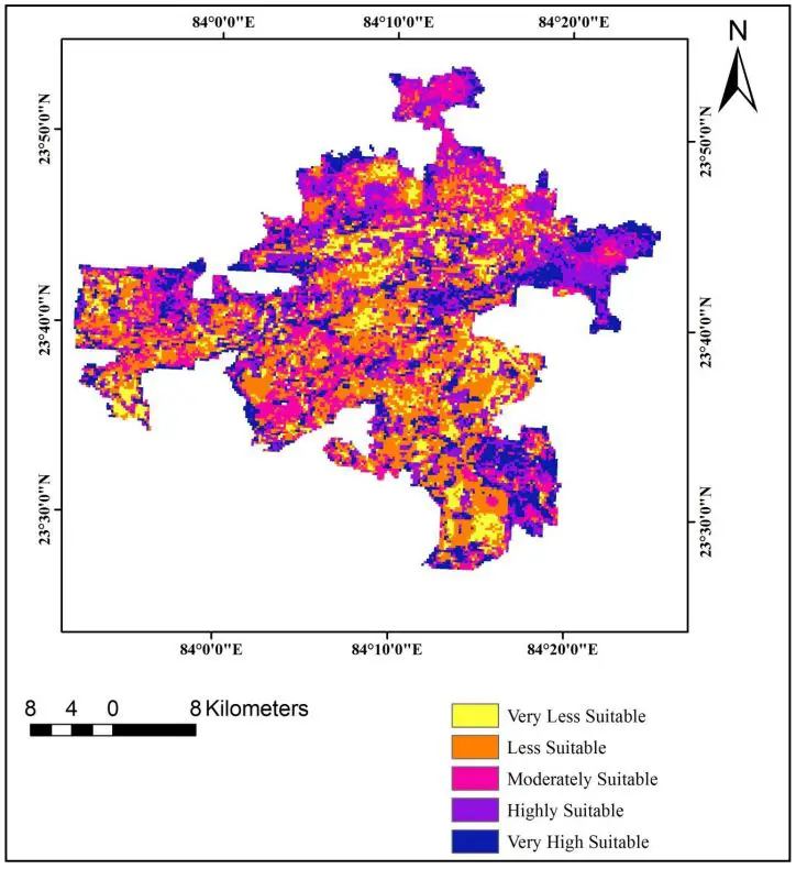
Jharkhand, India: Elephant Habitat Suitability in Palamau Tiger Reserve
The Elephant Habitat Suitability project in the Palamau Tiger Reserve uses geoinformatics to identify and protect suitable habitats for elephants. The methodology involves using GIS to map current elephant habitats and remote sensing to monitor changes in vegetation and water availability.
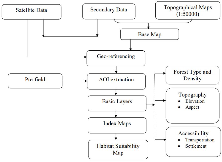
Data from GPS collars is used to track elephant movements and identify critical habitats. The project has resulted in the identification of key habitats that are now prioritized for protection and management.
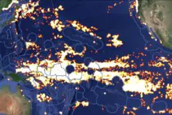
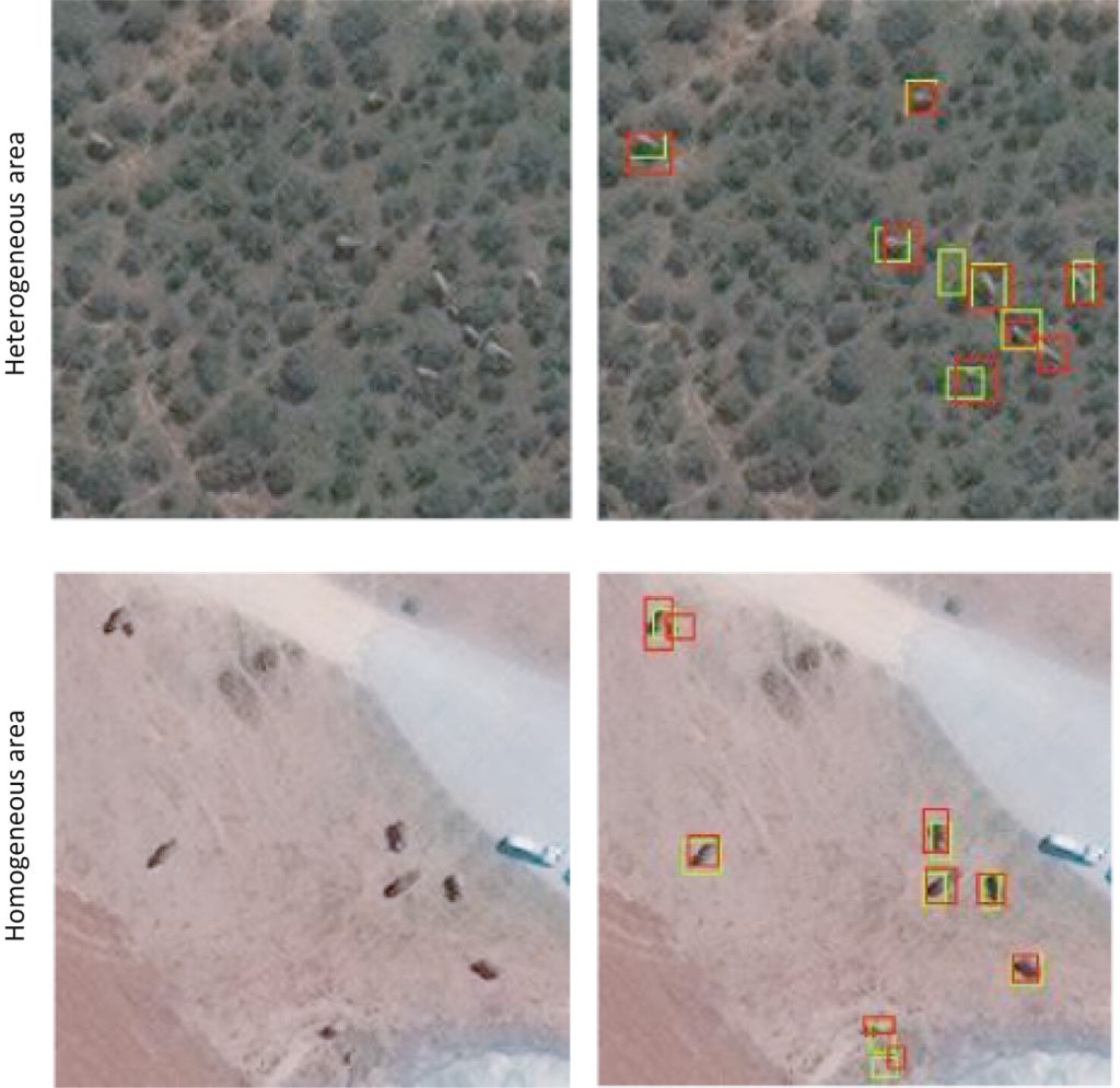
Global: Hexagon’s Use of Satellite Imagery and Machine Learning
Hexagon’s project leverages satellite imagery and machine learning to detect and monitor elephants. High-resolution satellite images from sources like WorldView-3 and WorldView-4 are processed using machine-learning algorithms to identify elephants and monitor their populations. This approach provides accurate and up-to-date information on elephant numbers and movements, helping conservationists to make informed decisions. The results have shown improved accuracy in population estimates and a better understanding of elephant distribution.
This approach also provides a non-invasive and efficient method for monitoring elephant populations over large areas, even in challenging and diverse environments. The results showcased the potential of combining advanced satellite technology with AI to enhance wildlife conservation efforts by providing precise and timely data on animal populations.
Future Trends and Innovations
The future of wildlife conservation looks promising with the advancement of geospatial technology:
- Upcoming Advancements: Emerging technologies such as AI and machine learning are being integrated with geospatial tools to enhance data analysis and predictive modeling. AI can analyze large datasets quickly, identifying patterns and predicting future changes that would be difficult for humans to detect. Machine learning algorithms can be trained to recognize specific animal species in satellite images, improving monitoring accuracy.
- Integration with Other Technologies: The combination of geospatial technology with AI, big data, and the Internet of Things (IoT) will enable more precise and efficient conservation efforts. For example, IoT devices such as environmental sensors can provide real-time data on habitat conditions, which can be integrated with GIS for comprehensive analysis. AI can process this data to identify trends and inform conservation strategies.
- Potential for Global Cooperation and Policy Changes: Geospatial technology facilitates global collaboration by providing standardized data and tools that can be used across borders. International conservation efforts can benefit from shared data and coordinated strategies. Policy changes supporting the adoption of these technologies will further enhance conservation efforts by providing funding and regulatory support.
Conclusion
Geospatial technologies plays a transformative role in wildlife conservation. From tracking and monitoring to habitat analysis and anti-poaching efforts, these tools provide critical data and insights that are essential for effective conservation strategies.
The continued advancement and integration of geospatial technology with other innovative solutions hold great promise for the future of wildlife conservation.