HARRIS Geospatial Solutions Webinar: The Applications and Benefits of Synthetic Aperture Radar (SAR)
Synthetic Aperture Radar (SAR) is rapidly becoming a key dataset in geospatial investigation. Unlike many other observational methods, SAR is not limited by illumination or cloud cover. In recent years, due to an ever-increasing number of orbital SAR instruments, and more yet to come, there has been a significant increase in data quality and availability requiring processing software to evolve. As a result, automated SAR-based analytical workflows can now run at-scale to solve problems across a wide range of disciplines including disaster preparation and response, urban development and land use, agriculture, change detection, and monitoring across land and sea.
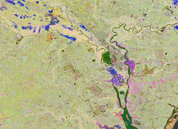
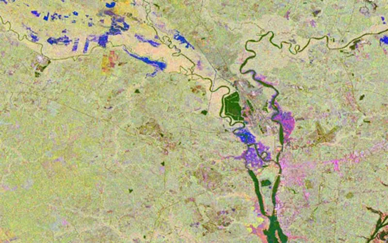
SAR floodmap of Wilmington, NC.
Harris Geospatial Solutions
In this webinar you will:
- Learn the basics of SAR
- See several examples of how you may use SAR in your own projects:
- DEM generation
- Flood mapping and disaster management
- Deforestation
- Activity monitoring
- See how you can use ENVI SARscape to process and analyze SAR data, generate products, and integrate information with other geospatial products.
When: Thursday, December 6, 2018
This webinar is being offered three times to fit different time zones. It will be presented in English.
Please register for the webinar in your time zone below:
Source: HARRIS Geospatial Solutions