How Remote Sensing and GIS are Used to Build Check Dams Under MGNREGA?
Mahatma Gandhi National Rural Employment Guarantee Act (MGNREGA) aims at enhancing the livelihood security of people in rural areas by guaranteeing hundred days of wage employment in a financial year to a rural household whose adult members volunteer to do unskilled manual work.
MGNREGA has always been in news for the adoption of geospatial technologies in water conservation, land restoration, geo-tagging of assets, and digitization and decentralization of MGNREGA work.
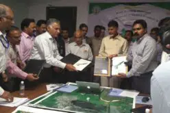
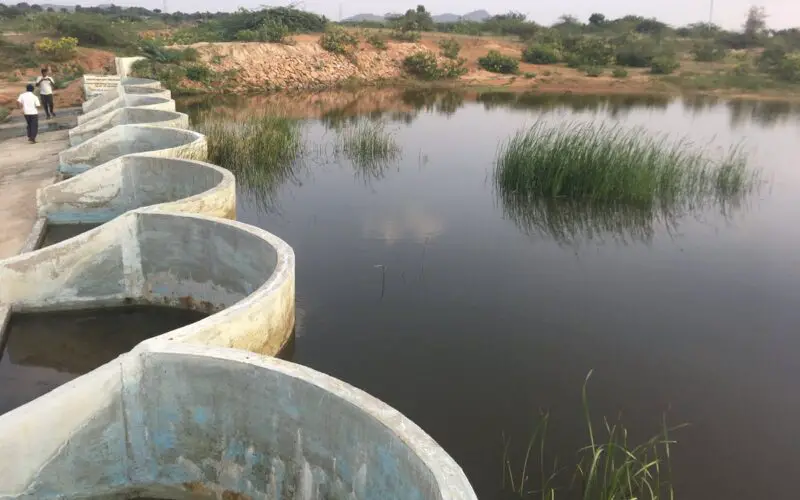
Recently The Hindu has reported that the Karnataka State government is promoting the construction of new generation check dams across natural streams, rivulets, and other water bodies under the MGNREGA program. Over 5,000 multiple arch buttress check dams (MACD) have come up under MGNREGA, 1,820 in the last two years.
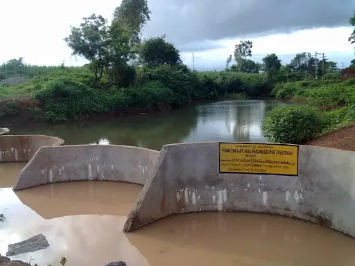
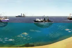
Check dams are important to harvest rainwater, act as temporary impounding structures, and recharge the aquifer. Apart from providing water to farmers in drier months, they act as water holes for wildlife too.
Aniruddha Shravan, Commissioner, MGNREGA, said to The Hindu that services from Karnataka State Remote Sensing Application Centre are being used to find a suitable site or probable locations for check dams. This helps to ensure the best site for check dam construction and to prevent unscientific construction.
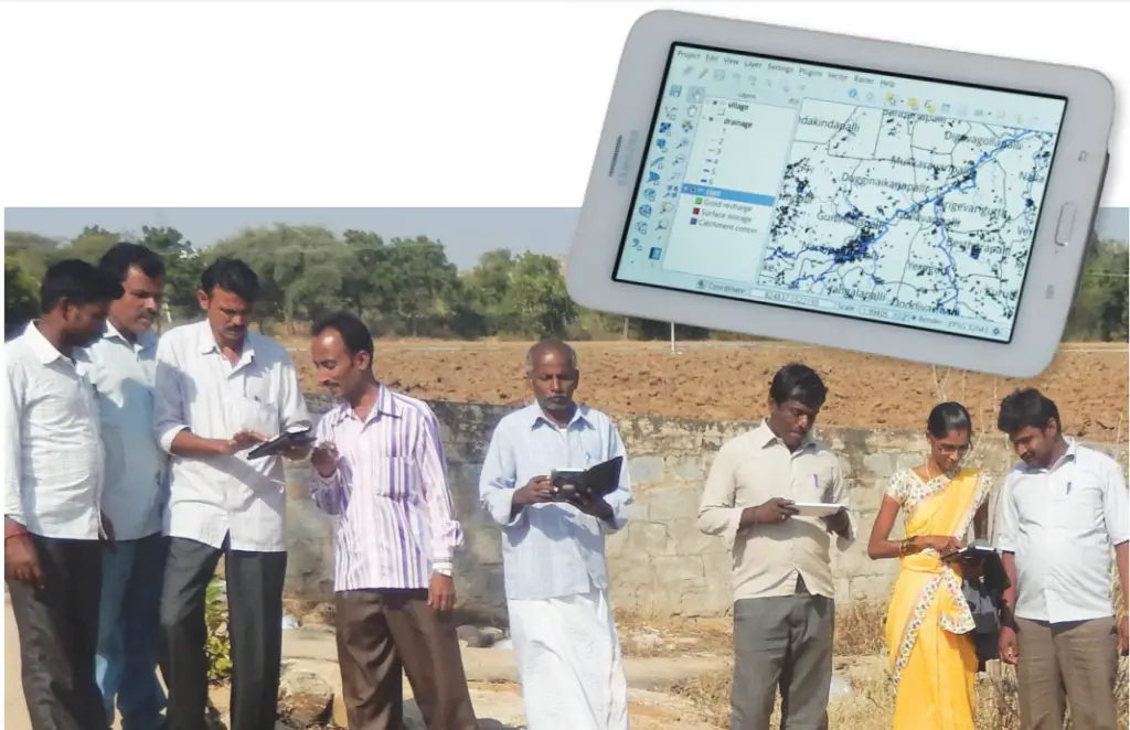
The Commissioner also mentioned that they have been using an app designed by the Foundation for Ecological Security called Composite Landscape Assessment and Restoration Tool (CLART) to locate dams near appropriate strata. With the help of CLART can choose a site where the stream is at its narrowest width, as it reduces costs and to see that the stream should not be meandering as it can cause flooding and shifting of the river’s course.
CLART is a Geographic Information System (GIS) tool developed to address an observed gap in considering different, equally important parameters while planning region-specific soil and water conservation measures.
CLART aids in composite planning that is based on scientific data, ground-truthing in the field, and estimation of resources. The tool was developed as part of the Water Commons project supported by the Hindustan Unilever Foundation. The tool has been awarded the Mobile for Good Award by the Vodafone Foundation.
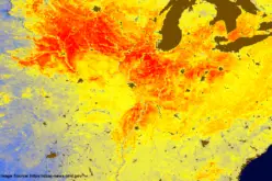
Scientific recommendations are translated through color-coded maps that depict recharge potentiality by overlaying layers of lithology, drainage, slope, land use, and land cover. Recommendations help the user identify the optimum location for a water harvesting structure.
After a location-specific structure is identified, the user can input measurements such as length/width/height into the Excel-based design estimate tool that generates approximate cost, labor, and design for the proposed structure. This can be saved for future activities such as preparing plans or detailed project reports.
Salient Features of CLART
- Provides location and context-specific data, improving planning and decision-making by 70-80%
- A combination of Q-field software for GIS mapping and an excel-based tool (Design Estimate) for technical designs, helps rural users evolve plans and prepare budgets
- Available in offline mode as it uses GPS to pinpoint a location on the tablet where the color code on the interface suggests possible activities
- CLART is an open-source tool loaded on Android-based devices
Scientific recommendations are translated through color-coded maps that depict recharge potentiality by overlaying layers of lithology, drainage, slope, land use, and land cover. Recommendations help the user identify the optimum location for a water harvesting structure.
MACDs have brought a long-lasting change in districts like Vijayapura, Bagalkot, and the drier taluks of Belagavi. In fact, in several villages in the Vijayapura district, groundwater levels have also increased.
The MACD model was introduced by the Bidar Zilla panchayat in 2004. Now, Bidar has over 700 MACDs. The design was approved for MNREGA in 2015.
Also Read –
ISRO to Monitor Water Bodies in Tribal Areas Using Geospatial Technology