India and US to Enhance Earth Understanding with NISAR Satellite Launch in Early 2024

In a landmark collaboration, India and the United States are set to launch NISAR, a joint microwave remote sensing satellite for Earth observation, in the first quarter of next year, as announced by Union Minister Dr Jitendra Singh during a meeting with a high-level delegation of NASA led by its Administrator Mr Bill Nelson.
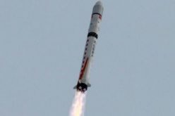
NISAR is scheduled to be launched aboard India’s GSLV. The information gathered by NISAR will be particularly valuable for examining land ecosystems, solid earth deformation, mountain and polar cryosphere dynamics, sea ice variations, and coastal oceans on a regional to global scale.
It has been communicated that the integration of ISRO’s S-band SAR with NASA’s L-band SAR took place at JPL/NASA. The combined L & S band SAR is presently undergoing testing with the satellite at URSC, Bangalore, with the active involvement of NASA/JPL officials.
ISRO and NASA have formed a Joint Working Group (JWG) on Human spaceflight cooperation and are exploring cooperation in radiation impact studies, micro meteorite & orbital debris shield studies; space health and medicine aspects. The 8th meeting of India-USA Joint Working Group on Civil Space Cooperation (CSJWG) was held in Washington DC in January 2023.
ISRO/DoS is also in discussion with prominent US industries (like Boeing, Blue Origin & Voyager) on specific items of cooperation and also to explore joint collaborations with Indian commercial entities.
The Indian side informed that a concept paper on the Implementing Arrangement (IA) is under consideration between ISRO and NASA. After a few iterations, both sides arrived at a mutually agreed draft and the same is processed for intra-Governmental approvals.
Mission Themes Overview
- NISAR would measure surface deformation to determine the likelihood of earthquakes, volcanic eruptions, and landslides, and monitor groundwater, hydrocarbon, and sequestered CO2 reservoirs.
- NISAR would determine how climate and ice masses interrelate and raise sea level and will measure changes in sea ice, snow extent, permafrost, and surface melting.
- NISAR would determine the contribution of Earth’s biomass to the global carbon budget and characterize ecosystem disturbance and impacts on biodiversity.
- NISAR would measure aquifer extent and change over the Earth’s vulnerable water systems.

Using advanced radar imaging that will provide an unprecedented, detailed view of Earth, the NASA-ISRO Synthetic Aperture Radar, or NISAR, satellite is designed to observe and take measurements of some of the planet’s most complex processes, including ecosystem disturbances, ice-sheet collapse, and natural hazards such as earthquakes, tsunamis, volcanoes and landslides.
Data collected from NISAR will reveal information about the evolution and state of Earth’s crust, help scientists better understand our planet’s processes and changing climate, and aid future resource and hazard management. The mission is a partnership between NASA and the Indian Space Research Organization.


