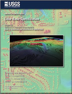
 The US Geological Survey National Geospatial Program is pleased to announce a new version of the USGS Lidar Base Specification that defines deliverables for nationally consistent lidar data acquisitions. The USGS Lidar Base Specification provides a common base specification for all lidar data acquired for the 3D Elevation Program (3DEP)
“Because we are acquiring data nationally for 3DEP with many partners, we need to have a way to ensure all of our requirements are being met, while minimizing the potential for problems with interoperability between various disparate data collections,” said Jason Stoker, Elevation Product and Services Lead for the USGS National Geospatial Program. “The USGS Lidar Base Specification helps everyone understand exactly what data we need and exactly how we need it, so we can be as efficient as possible. This new version incorporates many of the lessons we have learned since putting together version 1.0, and sets the stage for future quality 3DEP data collections.”
Originally released as a draft in 2010 and formally published in 2012, the USGS–NGPLidar Base Specification Version 1.0 was quickly embraced as the foundation for numerous state, county, and foreign country lidar specifications. Lidar is a fast-evolving technology, and much has changed in the industry since the final draft of theLidar Base Specification Version 1.0 was written.
Lidar data have improved in accuracy and spatial resolution, geospatial accuracy standards have been revised by the American Society for Photogrammetry and Remote Sensing (ASPRS), industry standard file formats have been expanded, additional applications for lidar have become accepted, and the need for interoperable data across collections has been realized. This revision to the Lidar Base Specification, known as Version 1.2, addresses those changes and provides continued guidance towards a nationally consistent lidar dataset.