
Tag "GIS tools"
Keeping Up with the Times: Applying GIS Tools for Flood Disaster Mitigation
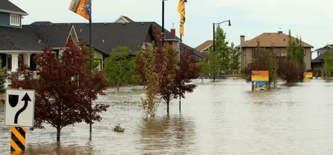
GIS is a powerful resource as it is accessible, free, and relevant for multiple stakeholders. Anyone can use GIS software to develop flood disaster mitigation strategies and avoid high-cost, flood-related damages on their property.

Find the Best Location – Boost Business with GIS Analysis
Find the Best Location – Boost Business with GIS Analysis Wednesday, 27th January 09:00 AM (GMT) Your Local Time (http://goo.gl/y6KG0H) Sales reports, buyer behaviors, public transportation and etc., you got

Explore How GIS Tools Help to Manage and Protect the Oceans
Ocean Solutions, Earth Solutions Esri Press Book Explores How GIS Tools Help to Manage and Protect the Oceans Ocean Solutions, Earth Solutions, a new book from Esri Press, chronicles how

Latest SuperGIS Desktop Enhances Editing Performance and Functionality
Developed by Supergeo, the updated SuperGIS Desktop 3.2 now provides users with a more powerful and comprehensive platform to display and edit GIS data by strengthening the performance, stability and
