Launch of Innovative GIS Certificate Program Taught by SMEs
Learn ArcGIS, Open Source GIS, and cloud on one EdTech platform
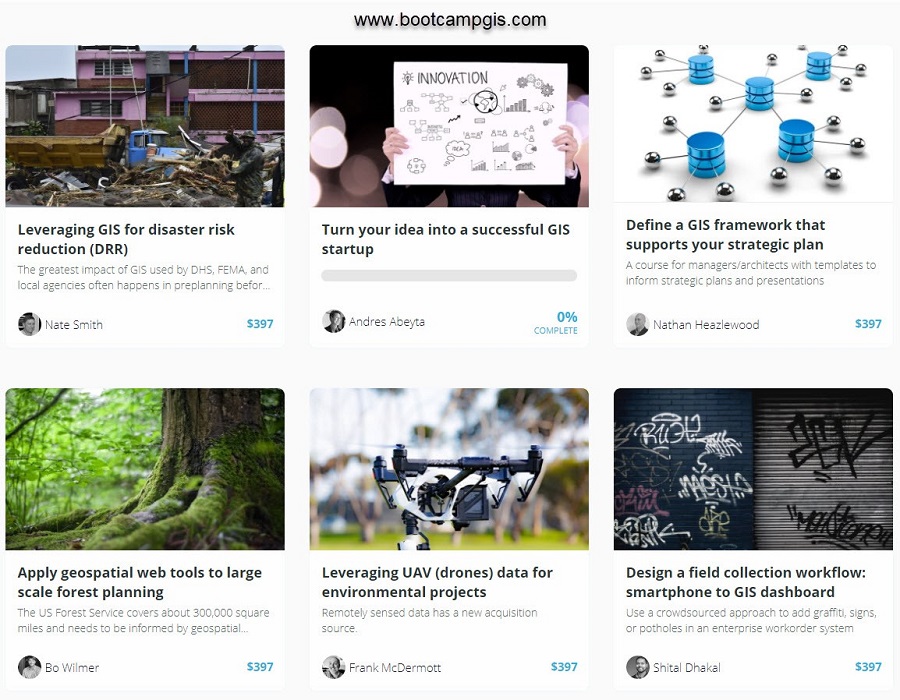
There is a new source for geospatial tech education that is exciting instructors and students, Bootcamp GIS. A growing library of courses are being taught by Subject Matter Experts that demonstrate their real projects through online short courses. The platform gives students the flexibility to pick a single course, build a certificate, start classes when they want, and choose tiers of instructor interaction. See How it Works. This GIS microcredential teaches portfolio building skills such as processing drone images, configuring a geoportal, coding a GIS machine learning model with Python, or authoring a GIS strategic plan. It’s the enterprise level skills that are being requested in the highest paying jobs in GIS. See GIS course listings.
Education paradigm shift to address tech learning
The pandemic has jolted the educational paradigm and there are some overdue changes being wrestled with to meet student needs. As consumers, they want real-time, Peer-2-Peer, and practical experiences. The Director of Bootcamp GIS, Andres Abeyta, says ‘I’ve grown weary of all the contrived tutorials I have seen over the years. Students deserve better so we made every course design decision to favor what they want. All of our online GIS courses are based on realistic use-cases, quickly consumable, and around half the cost of most university GIS certificate programs.’ Career counseling is provided for students who are pursuing their certificate which they can complete in as little as 6 months with rolling admissions. See a sample GIS student portfolio video.
Helping the GIS industry overcome their problem of finding talent
A major pain point that technical companies have is called the Skills Gap. The skills that they are hiring are not showing up in the portfolios of graduates with a degree in GIS. Abeyta confirmed this by saying ‘I have interviewed about 50 GIS managers and every single one of them finds it difficult to hire someone with the mix of IT and Geography skills to help support their enterprise map systems rather than just making a map.’ It’s of national interest to address this gap so that companies can decrease costs in recruiting and onboard training.
Visit www.bootcampgis.com to see about registering for a course. Anyone seeking opportunities to author a course or having a corporate HR partnership then please email: support@bootcampgis.com.
About Bootcamp GIS:
Bootcamp GIS is a geospatial education platform serving courses taught by subject matter experts. The platform helps students overcome their academic skills gaps or stay relevant with constantly evolving technology. All short courses are based on real industry projects which make students more marketable and more adept at architecting enterprise implementations.
Also Read –