Newly released US Topo maps for Louisiana feature select trails and other updates
Several of the 812 new US Topo quadrangles for Louisiana now display public trails along with improved data layers. Other significant additions include public land survey system information (PLSS), redesign of map symbols, enhanced railroad information and new road source data.
Some of the data for the trails is provided to the USGS through a nationwide crowdsourcing
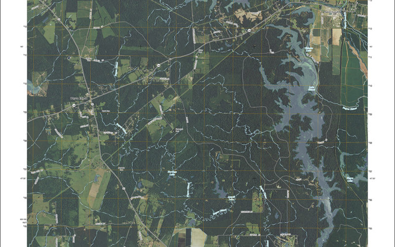
Updated 2015 version of Saint Landry quadrangle with orthoimage turned on. (1:24,000 scale)
“I am very excited about the 2015 US Topo maps for Louisiana!” said R. Hampton Peele, GIS Coordinator for the Louisiana Geological Survey. “These maps will provide a great reference for our Cartographic Section as we compile our annual geologic map deliverables for the USGS.”
For Louisiana recreationalists and visitors who want to explore the diverse Gulf coast landscape on a bicycle, hiking, horseback or other means, the new trail features on the US Topo maps will come in handy. During the past two years the IMBA, in a partnership with the MTB Project, has been building a detailed national database of trails. This activity allows local IMBA chapters, IMBA members, and the public to provide trail data and descriptions through their website. The MTB Project and IMBA then verify the quality of the trail data provided, ensure accuracy and confirm the trail is legal. This unique crowdsourcing venture has increased the availability of trail data available through The National Map mobile and web apps, and the revised US Topo maps.
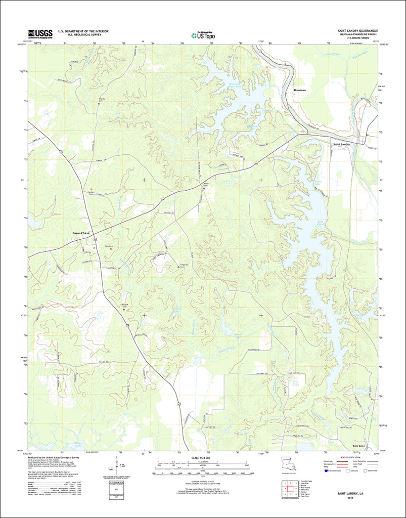
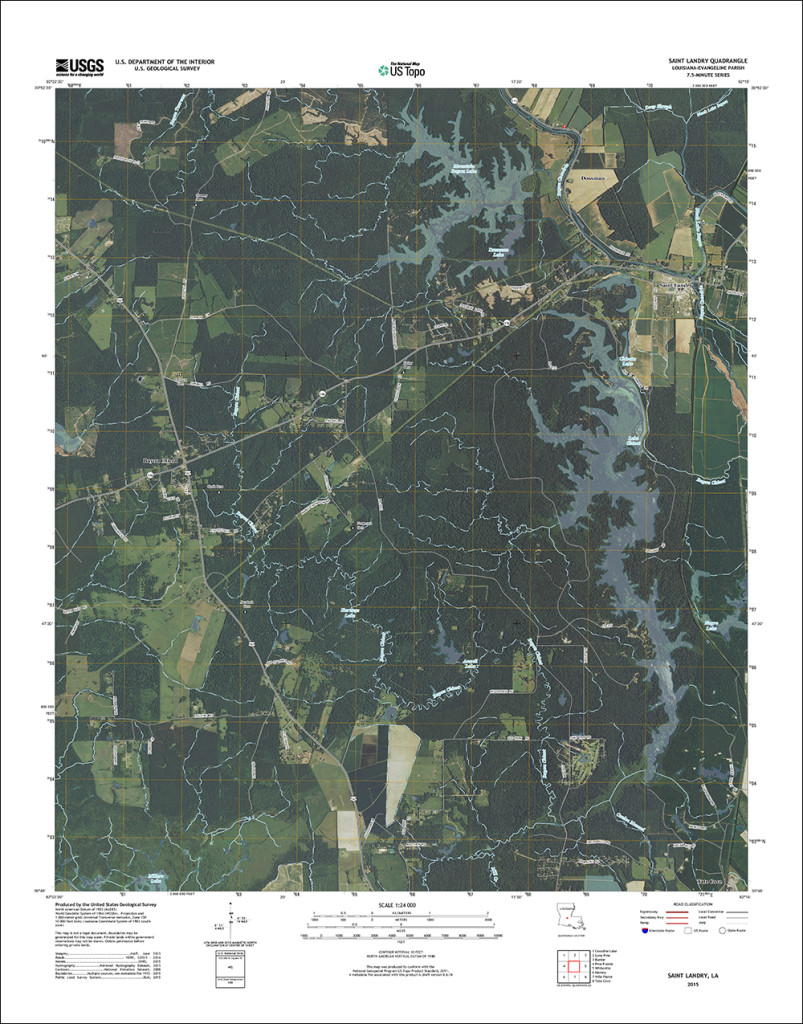
Updated 2015 version of the Saint Landry quadrangle with the orthoimage turned off to better see the contour intervals. (1:24,000 scale)
Additionally, a widely anticipated addition to the new Louisiana US Topo maps is the inclusion of Public Land Survey System data. PLSS is a way of subdividing and describing land in the US. All lands in the public domain (lands owned by the federal government) are subject to subdivision by this rectangular system of surveys, which is regulated by the U.S. Department of the Interior.
“The US Topo maps provide an excellent instructional tool in our GIS Certification Program,” said Brent Yantis, Director of the University of Louisiana Lafayette Regional Application Center. “They orient students to their environment and provide a fundamental foundation in the development of geospatial concepts. We look forward to this new release.”
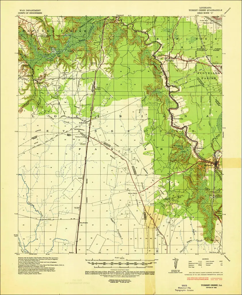
Scan of the 1935 USGS quadrangle of the Turkey Creek area (which covers the Saint Landry map) from the USGS Historic Topographic Map Collection. (1:62, 500 scale)
These new maps replace the first edition US Topo maps for the Pelican State and are available for free download from The National Map, the USGS Map Locator & Downloader website , or several other USGS applications.
To compare change over time, scans of legacy USGS topo maps, some dating back to the late 1800s, can be downloaded from the USGS Historical Topographic Map Collection.
For more information on US Topo maps: http://nationalmap.gov/ustopo/