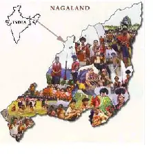
 Nagaland Science and Technology Council (NASTEC) has prepared a map on ‘Ground water prospects of Nagaland’.
NASTEC prepared the Hydro Geo-Morphological (HGM) Map under Rajiv Gandhi National Drinking Water Mission Project under the supervision of National Remote Sensing Centre, ISRO and sponsorship of the Ministry of Drinking Water and Sanitation, Government of India.
Nagland Chief Secretary C J Ponraj officially handed it over to Public Health Engineering (PHE) Department Chief Engineer Kevisekho Kruse during the inaugural function of a one-day workshop on Ground Water Projects Map of Nagaland here today.
The natural sources should be properly identified, Ponraj said adding that state has abundant rain for four months but due to lack of natural storages people have to suffer during the lean period. He therefore stressed on the need for undertaking major water storage facilities.
Delivering the keynote address, Advisor Union Ministry of Drinking Water and Sanitation, Shanmugan Sundaram said the idea of preparation of Groundwater Prospect Maps came out at a time when many of the partially covered habitations and Fully Covered habitations slipped back to Not Covered category.
The Union Ministry of Drinking Water had decided to entrust NRSC Hyderabad, the work of preparation of HGM Maps utilising remote sensing data, he said.
The main objective of HGM Map is to identify or select suitable places where water sources like dug wells, bore wells can be put up and also for identifying suitable sites for constructing water harvesting structures like check dams, nullah bunds, percolation ponds recharge pits.
Application of HGM Maps in the field by engineers and scientists is expected to yield sustainable drinking water sources and thereby to reduce the problem of slipped back habitations, he said.
– PTI


