
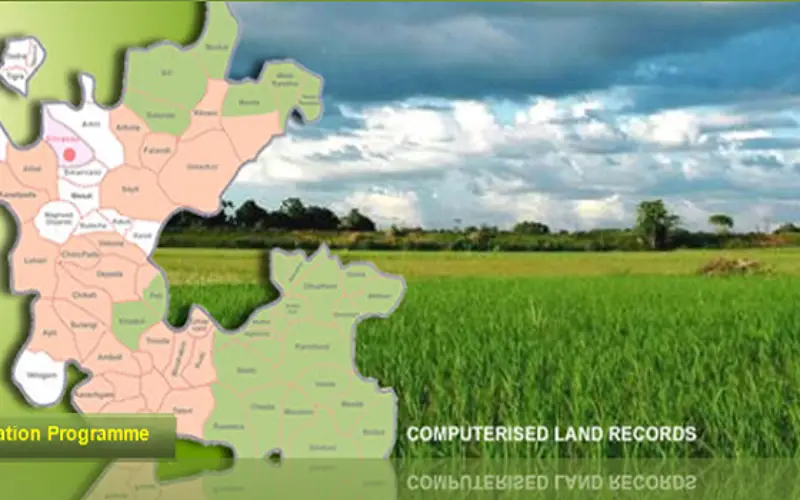
National Land Records Modernization Programme (NLRMP): A Government of India Flagship
Raja Todarmal had introduced land revenue, land survey and settlement system in India during the regime of great Mughal emperor Akbar. On the basis of land survey Raja Todarmal prepared the maps showing different holdings and assessed rents from individual, which probably were the first cadastral maps in India. The present system of land management in Indian subcontinent by Patwaris’ which was improved by British and Govt. of India has its origin from the Todarmal system of land survey and management.
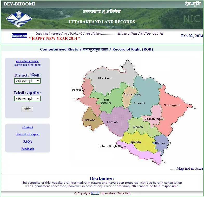
Uttarakhand Land Records
The Government of India has launched a nationwide programme called National Land Records Modernization Programme (NLRMP) in August 2008. NLRMP is the outcome of merger of existing two Centrally-Sponsored Schemes of Computerization of Land Records (CLR) and Strengthening of Revenue Administration and Updating of Land Records (SRA&ULR) in the Department of Land Resources (DoLR), Ministry of Rural Development. This move aimed to modernize management of land records and minimize scope of land/property disputes and to enhance transparency in the land records maintenance system in the country. Another objective of the NLRMP is to implement the conclusive land-titling system with title guarantee.
The activities which are to be taken up under the NLRMP is the development of core Geospatial Information System (GIS) and capacity building with the computerization of all land records, digitization of maps, survey/re-survey and updation of all survey and settlement records, computerization of registration and its integration with the centralized land records maintenance system.
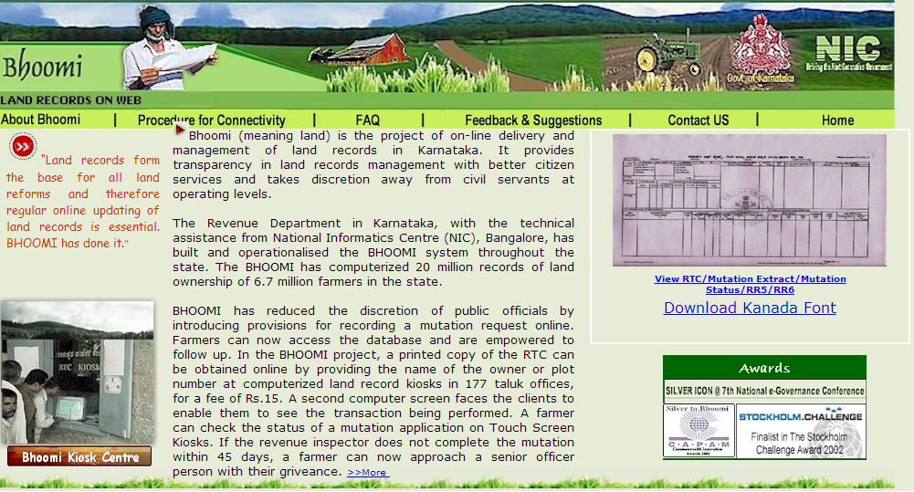
Bhoomi: Revenue Department of karnataka
The development of core GIS capacity includes preparation of village index base maps by geo-referencing cadastral maps with satellite imagery and integration of spatial data from aerial photography or either from high-resolution satellite imagery with the Survey of India and Forest Survey of India maps and GIS-ready digitized cadastral maps from revenue records. GIS capacity would allow seamless integration of information among various revenue offices and would be helpful for micro and macro-planning and other relevant applications provided the data is created by all the States/UTs.
The computerization of land records includes data entry/re-entry/data conversion of all textual records including mutation records and other land attributes data, digitization of cadastral maps, scanning & preservation of old documents and integration of spatial and non-spatial data. Further the approach of data computerization is divided into tehsil, sub-division/district and state-level data centers. There is also a provision of setting up of inter-connectivity among revenue offices.
The survey/resurvey and updation of the survey & settlement records includes various modern technology options. The task includes setting up of extensive and detailed network of ground control network and ground truthing. To accomplish this task various modern technologies can be used such as using total station (TS) and differential global positioning system (DGPS), hybrid methodology using aerial photography and ground truthing by TS and DGPS, use of high resolution satellite imagery (HRSI) and ground truthing by TS and DGPS.
The capacity building programme includes setting up of modern record rooms/land records management centres at tehsil/taluk/circle/block level, training, workshops, etc. and strengthening of the Survey and Revenue training institutes.
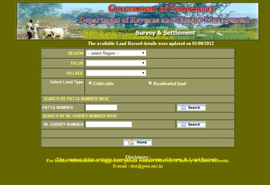
Department of Revenue and Disaster Management
The Centrally-Sponsored NLRMP has to be by the State Governments/UT Administrations with financial and technical supports from the Dept. of Land Resources, Government of India. A total of Rs. 11056.40 lakh was allocated for State/UTs for the year 2011-12 . It has been decided to cover the entire country by the 12th Plan period.
Ministry of Rural Development, Government of India has launched a web portal for NLRMP. There are various options provided for the citizens and authorities such as Implementation Status of Data Entry and ROR Updation(Mutation), State Generic Details, State Generic Details District Release Of Fund Detail, Approved Proposals.
The implementation of land records information system management over the internet gives rise to new concerns relate to security of information system assets and data integrity. In solution to this two sets of standards have been codified by the International Organization for Standardization (ISO): one is the ISO/IEC 27001, also called the information security management system (ISMS) standard of 2005; the other is ISO/IEC 27002:2005, a codification of practices for information security management.
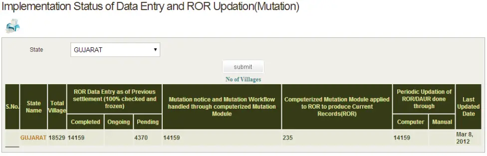
NLRMP Web Portal
NLRMP will not facilitates government organization in bring transparency in land record management and policy making but also have many advantages to the citizens. The programme will facilitate real-time land ownership records will be available to the citizen through a single-window service or the web-enabled “anytime-anywhere” access, the interconnectivity among various department will drastically reduce time for obtaining RoRs, etc., free accessibility to the records will reduce interface between the citizen and the Government functionaries, thereby reducing rent seeking and harassment, conclusive titling will also significantly reduce litigation and these records will be tamper-proof.
To visit NLRMP


I have a land problem which I desire should be sought out through your kind service as mentioned in your web-site.
I am in possession of revenue land at Bangarapet taluk, and possess the valid documents there off. An error has been committed by the department and need to get it corrected.
Hope this he programme will facilitate real-time land ownership records will be available to the citizen through a single-window service or the web-enabled “anytime-anywhere” access, the interconnectivity among various department will drastically reduce time for obtaining RoRs, etc., free accessibility to the records will reduce interface between the citizen and the Government functionaries, thereby reducing rent seeking and harassment, conclusive titling will also significantly reduce litigation and these records will be tamper-proof.
Where can I find your esteemed office. Please inform through email or mobile:9341173197.
With due regards,
Paul Ponniah