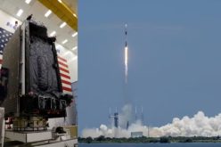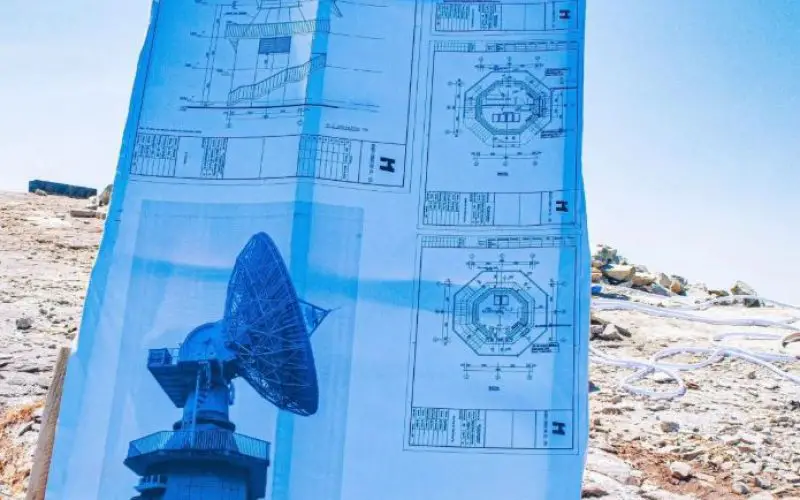
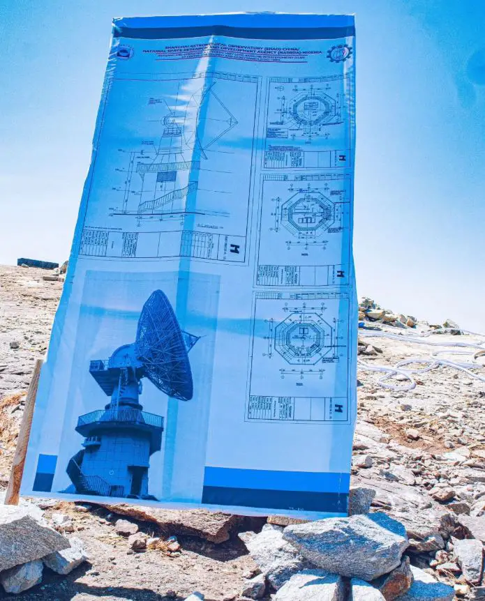
Nigeria recently marked a significant milestone in its scientific and technological landscape with the groundbreaking ceremony for the country’s first Geodetic VLBI project. The event, held at the Center for Geodesy and Geodynamics (CGG) in Toro, Bauchi State, was officiated by Dr. Mathew Adepoju, Director General of the National Space Research and Development Agency (NASRDA).
This project is a collaboration between Nigeria and China’s Shanghai Astronomical Observatory (SHAO) and aims to elevate Nigeria’s role in global geodesy and space science.
What is VLBI and its Importance in Geodesy?
Very Long Baseline Interferometry (VLBI) is a technique used in radio astronomy that involves multiple radio telescopes observing the same celestial object simultaneously. By measuring the time differences in signal reception between these telescopes, Geodetic VLBI can pinpoint locations with extraordinary precision.
This technique is crucial in geodesy, the science of measuring and understanding the Earth’s geometric shape, orientation in space, and gravity field.
VLBI plays a vital role in tracking tectonic plate movements, studying Earth’s rotation, and monitoring deep-space phenomena, all of which contribute to more accurate global positioning systems and mapping.
Also Read – Nigeria Renews Partnership with NASA to Advance Space Geodesy and Geohazard Research
Nigeria’s VLBI Project: Aiming High in Science and National Development
The multi-million-dollar Geodetic VLBI project in Nigeria is set to provide diverse capabilities. These include monitoring geodynamic events like earthquakes, tracking satellites and space missions, and determining Earth’s orientation parameters. The project’s benefits extend to national security, disaster mitigation, and advancing Nigeria’s position in space science.
Also Read – NASA Awards Very Long Baseline Interferometry Support Services
This pioneering project is expected to play a significant role in the African VLBI Network (AVN), a continent-wide initiative to enhance Africa’s capacity in geodesy and radio astronomy. Until recently, only South Africa’s Hartebeesthoek Radio Astronomy Observatory (HartRAO) had participated in global Geodetic VLBI experiments.
With Ghana’s recent conversion of a defunct telecommunication dish into a VLBI-capable radio telescope, Nigeria’s project will bolster the West African contribution to this network, filling a critical gap in global and regional geodetic observations.
Benefits of Nigeria’s Geodetic VLBI Project
The Nigerian VLBI initiative will offer several key benefits:
- Enhanced Accuracy in Mapping: The project will contribute to the establishment of an accurate reference frame for Africa, crucial for precise surveying and mapping.
- Data Sharing and Research: By sharing VLBI data with international partners, Nigeria will support global research, enhancing understanding of Earth’s dynamics.
- Space Science Contributions: Nigeria’s involvement in VLBI experiments will position the country as a contributor to global space missions and scientific exploration.
- Economic and Technological Growth: The project symbolizes Nigeria’s commitment to advancing technology and fostering economic development through scientific collaboration.
As Nigeria joins the African VLBI Network, it positions itself as a key player in the scientific community, promising advancements that will benefit both the nation and the world at large.
Source: Space in Africa