Qatar to Develop 4D Mapping Technology to Boost Urban Planning and Other Applications

According to recent news by The Peninsula, the Center for Geographic Information Systems(CGIS) under the Ministry of Municipality and Environment is working on a cutting-edge technology to develop 4D mapping features in GIS to further boost urban planning and many other applications in the country.
This was revealed by Manaf Ahmed Al Sada, Director of CGIS at an event held on the occasion of the World GIS Day (November 15).

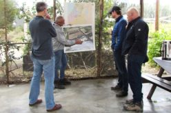
Senior officials at an annual get-together marking the World GIS 2017 celebrations.
Credit: The Peninsula
The CGIS Director said: “The growth rate of Qatar has truly been phenomenal and a lot of the success is owing to our ability to adapt to new technologies that aid in improving infrastructure, logistics and customer satisfaction. Agencies and organizations throughout the world use GIS to incur minimal transportation complexities while empowering users to connect with dynamic environments in new and creative ways.”
Manaf Al Sada, presented a keynote and discussed changing trends in the GIS technology and how the user base is becoming much wider with the increasing availability of GIS tools and services to government agencies and the general public. He stressed the importance of data sharing among all agencies and the continuous update of data.


It is excellent attempt for use of GIS tech. in urban planning.
Morad Ahmad
Ex. Chief Town Planner
GOA
India