
Tag "mapping"
USGS Uses Remote Sensing for Groundwater Mapping in Kenya
Groundwater mapping in Kenya has received a major boost through the use of remote sensing technologies, spearheaded by the U.S. Geological Survey (USGS), USAID, and Northern Arizona University. Remote sensing

Trimble Introduces New Direct Georeferencing Portfolio for UAV Mapping
Trimble (Nasdaq: TRMB) has announced the launch of premium direct georeferencing solutions for mapping sensors on uncrewed aerial vehicles (UAVs) – the Trimble® APX RTX portfolio. When used by original
Golden Software Enhances Surfer® Mapping and 3D Visualization Package with Map Templates and Online Image Access
Golden Software has added significant time-saving features to the latest version of its Surfer mapping and 3D visualization software. Users can now choose from more than 20 frame templates to

How Digital Twin for Housing is Transforming Home Selection in Abu Dhabi
The Abu Dhabi Housing Authority (ADHA) is pioneering a significant technological leap with the adoption of digital twin technology for housing. This innovative approach focuses on creating a highly interactive
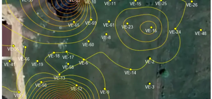
Boosting Revenue with GIS-based Cess Collection in Bihar
The Bihar government is implementing a GIS-based cess collection system to cover all construction activities, whether government, commercial, or private, across the state. This innovative approach, led by the state’s
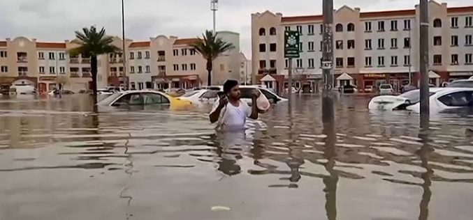
Oman Begins Comprehensive Flood Risk Mapping to Enhance Safety
Oman is initiating a major project focused on Flood Risk Mapping across the country. The Ministry of Agriculture, Fisheries, and Water Resources has engaged a specialized company to lead this

USGS Advances Colorado Geological Mapping with Low-Flying Helicopters
The U.S. Geological Survey (USGS) has launched an extensive project to map Colorado’s geological history using low-flying helicopters equipped with sophisticated geophysical instruments. Starting in mid-August 2024, these flights will
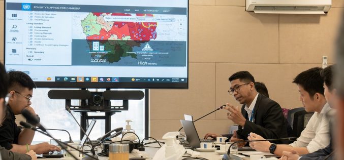
UNDP Unveils AI-Powered Mapping Tool to Combat Poverty in Cambodia
The United Nations Development Programme (UNDP) has introduced the “Cambodia Poverty/Vulnerability Mapping Tool,” an innovative AI-powered platform designed to address socio-economic vulnerabilities across Cambodia. This tool represents a significant advancement

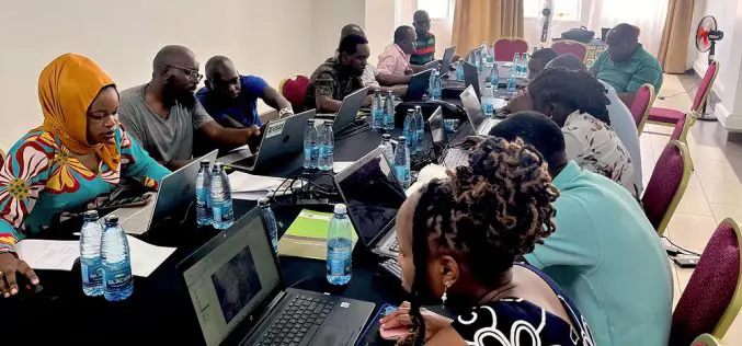
Soil Quality Analysis for Smart and Sustainable Farming
In the picturesque landscapes of Europe, a silent revolution is taking place in the fields of countless farms. At the heart of this transformation is the Soil Quality Analysis Tool

Apple Maps Goes Web Challenges Google
Apple has officially launched Apple Maps on the web in a public beta, marking a bold step to challenge the dominance of Google Maps. This move allows users to access
