
Tag "arcgis"

Esri Publishes Getting to Know ArcGIS, Fourth Edition
Use the Workbook and Exercises to Get Started Making Maps and Analyzing Data Learn the fundamentals of making digital maps, analyzing geospatial data, and building and editing spatial databases using
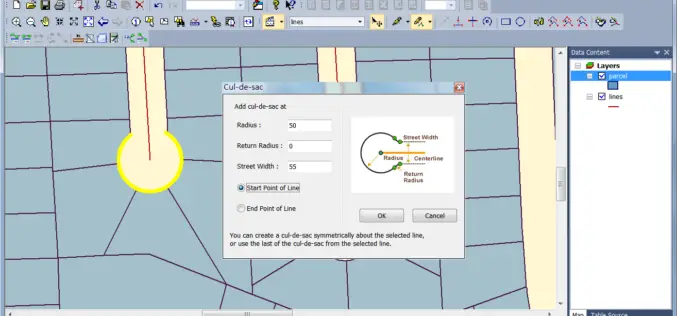
Australian Land Survey Firm Increases Map Quality by SuperGIS Desktop
Supergeo Technologies, the leading GIS software and solution provider, announces that SuperGIS Desktop assists Mesurage Group Pty Ltd, Australia to process surveyed data for value-added applications and services. Located in

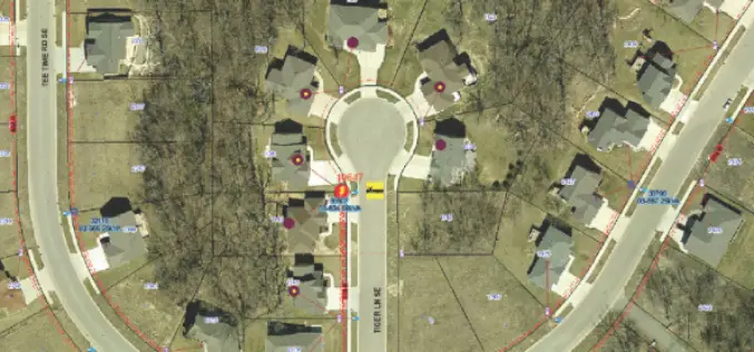
City of Oakland’s Real-Time Crime Map Advances Transparency
Oakland Police Department Aims to Drive Citizen Engagement with Open Data Redlands, California—The City of Oakland, California, has taken another step toward offering citizens open access to public data by
Esri Joins International Partnership to Enhance Climate Resilience in Developing Countries
Colombia, Ethiopia, and Bangladesh to Harness ArcGIS Platform to Achieve Long-Term Sustainability Redlands, California—In a next phase of support of The White House Climate Action Plan, Esri will donate its best-of-breed
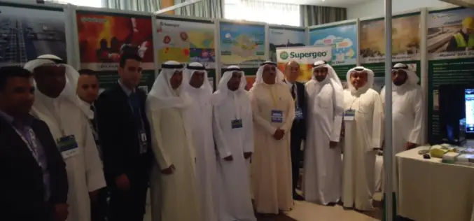
Kuwait Institute for Scientific Research Selects SuperGIS to Enhance Spatial Data Quality
Supergeo long-term partner, KISR, Kuwait Institute for Scientific Research, has adopted the latest SuperGIS Desktop 3.3 and SuperPad 3.3 to not only raise GIS work effectiveness, but also strengthen the

Esri India Webinar: Location Analytics for Insurance
Esri India Webinar: Location Analytics for Insurance Tuesday, April 28, 2015 1:30 pm (IST) Insurance is a location centred business. Helping customers mitigate loss relies heavily on location information. When
Minnesota Municipality Using GIS for Public Utilities Outage Management
In recent news by American City & County, Minnesota municipality is using GIS for efficient handling of public utility outages. A Minnesota based company “Rochester Public Utilities”, provides services to more than 47,000 power
TerraGo Publisher Version 6.7 Delivers Free GIS-Lite Applications from ArcMap
TerraGo Publisher for ArcGIS is an extension to Esri ArcGIS that allows you to produce and exploit GeoPDF documents with ArcMap. You can define global defaults to be used when

Introduction to GIS for Agriculture: Rangeland Focus Workshop
Introduction to GIS for Agriculture: Rangeland Focus Workshop Wednesday, April 15th, 2015, from 8:00am to 1:00pm Informatics and GIS Program (IGIS) by University of California aims to support research technology
Esri Live Training Seminars on Utility Asset Inspection Using ArcGIS
Esri Live Training Seminars on Utility Asset Inspection Using ArcGIS Thursday, April 16, 2015 Learn how to configure and deploy focused ArcGIS maps and apps that support common inspection workflows.
