
Tag "arcgis"
Unveiling the Latest Enhancements in ArcGIS Business Analyst Enterprise: May 2024 Update
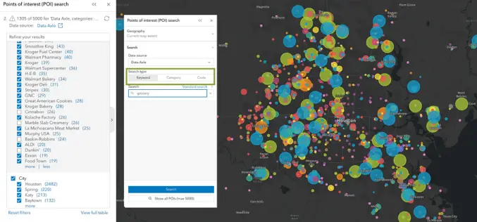
Esri has announced an exciting array of updates in the May 2024 release of ArcGIS Business Analyst Enterprise, enhancing its capabilities for businesses seeking to leverage geographic data for better
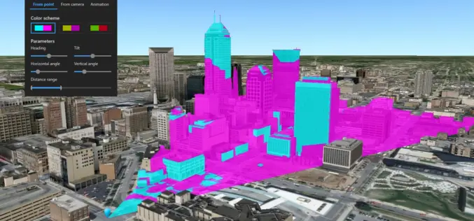
What’s New in ArcGIS Earth v1.8?
Recently Esri has introduced the latest version of ArcGIS Earth v1.8. ArcGIS Earth 1.8 delivers interactive analysis tools such as elevation profile, 3D measure, line of sight, and viewshed—with much more
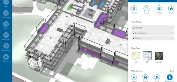
Esri Announces New Indoor Mapping Product
Redlands, California, June 9, 2018 – Esri , the global leader in location intelligence, today announced it will release ArcGIS Indoors, which will enable interactive indoor mapping of corporate facilities, retail and commercial
Esri Releases Survey123 for ArcGIS with New Spike Integration
Mobile Data Capture Solution Combines Laser Measurement with Powerful Mapping Tools Redlands, California – March 6, 2018 – Esri, the global leader in spatial analytics, today announced the new software release of
Esri Releases World’s First Complete Utility GIS Platform
New Utility Network Management Extension Combines Advanced System of Record with Location-Based Analytics Redlands, California – January 22, 2018 – Esri, the global leader in geographic information system (GIS) technology and spatial analytics,
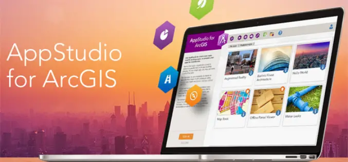
AppStudio version 2.1 for ArcGIS is Now Available
Esri’s AppStudio for ArcGIS is a pioneering tool in the GIS app development. It helps to create simple maps into beautiful mobile app friendly ready for various mobile operating systems such as iOS, Android, Windows etc, with no developer skills required.

UrtheCast and Esri Partner in Bringing Imagery to Life in ArcGIS
Madrid, Spain, July 11, 2017 – UrtheCast Corp. and its subsidiary, the Earth Observation company Deimos Imaging, today announce a broad partnership with Esri, starting with a new UrtheCast imagery service
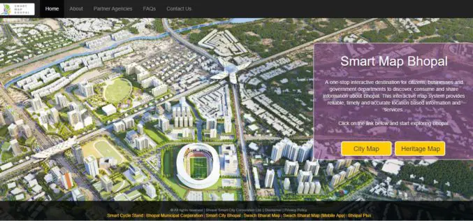
Smart Map Bhopal: A City Level Web-Based GIS solution
Smart Map Bhopal is an enterprise-wide web-based GIS solution created using ArcGIS platform and seamlessly functions across various the web & mobile devices. GIS System will provide

CompassCom to Release CompassTracker App for iOS & Windows Mobile Smart Phones at Esri User Conference
CENTENNIAL, Colorado, 6 July 2017 – CompassCom Software, developers of industry-leading Mobile Resource Management (MRM) solutions, will release CompassTracker for iOS and Windows Mobile at the 2017 Esri User Conference.
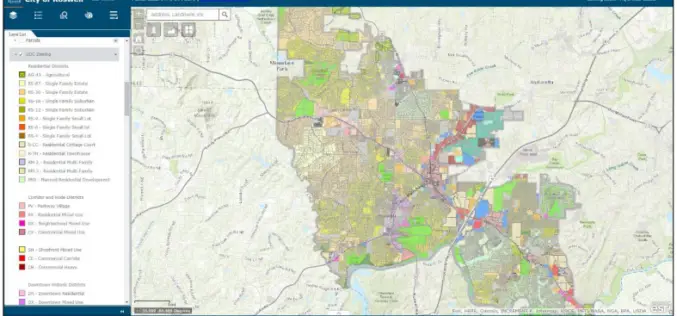
City of Roswell: A Case Study – Creating and Maintaining a GIS Enterprise
Introduction The bustling City of Roswellhas seen its population increase substantially over the course of the last twenty years, becoming the eighth largest city in the State of Georgia. Although
