
Tag "Biodiversity"
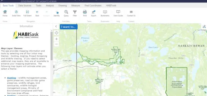
Government of Saskatchewan Launches New Hunting, Angling and Biodiversity Mapping Tool
The Ministry of Environment, Saskatchewan launched a new client-centred, online mapping tool called HABISask (Hunting, Angling and Biodiversity Information of Saskatchewan) that combines new and existing information on hunting, angling,
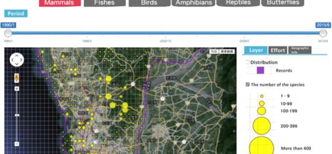
Conserve Biodiversity with GIS – Kaohsiung City Biodiversity Database
As environment becomes the top issue in every country, governments and scientists are eager to find the balance between development and environment protection. GIS as the key solution, offers various
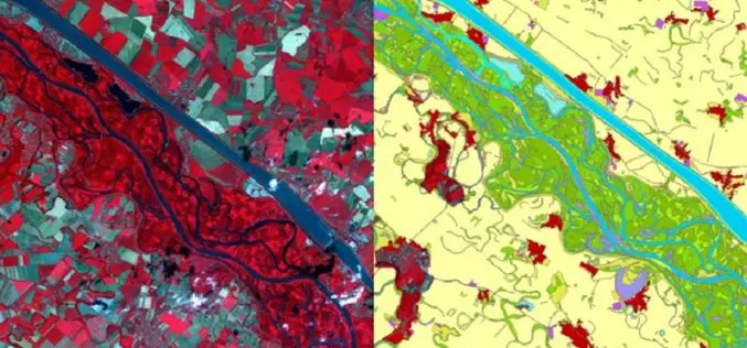
Copernicus: A Tool for Monitoring Europe’s Ecologically Sensitive River Banks
Riparian zones are fragile, yet environmentally important areas, and carry out a range of “ecosystem services”, such as filtering water, supporting wildlife and stabilising river banks. Within the Copernicus programme,

Ten Ways Remote Sensing Can Contribute to Biodiversity Conservation
WCS, NASA, And other conservation and remote sensing agencies, universities and NGOs focus on top 10 conservation questions for satellite technology Remote sensing has and can continue to play a
