
Archive

Government of South Australia Releases Geoscientific Data
The State Government has released a major package of geoscientific data in one of the State’s most underexplored provinces. Speaking today at the 8th annual Mining South Australia Conference in
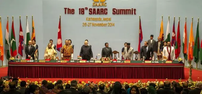
Indian PM Announces Satellite for SAARC Nations
In recent news by Shanghai Daily , during the inaugural session of the 18th South Asian Association for Regional Cooperation (SAARC) in Kathmandu, Nepal, Indian Prime Minister Narendra Modi said the

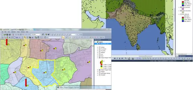
DoT : GIS Mapping of Telecom Towers
According to recent news by Economic Times, Department of Telecommunications (DoT), Government of India, has asked the telecom service operators in the country to put 584,000 telecom towers on Geographic Information

Mapping of Multi-Hazard Coastal Vulnerability
Earth System Science Organization (ESSO) – Indian National Centre for Ocean Information Services (INCOIS), Hyderabad and ESSO-Integrated Coastal and Marine Area Management (ICMAM), Chennai have carried out mapping and demarcating of

Webinar Trimble TerraFlex: Introducing Data Update Workflows
Trimble TerraFlex: Introducing Data Update Workflows December 10, 2014 Register for 8am MST (4:00pm Paris) Register for 4pm MST (10:00am Sydney) Trimble® TerraFlex™ software—the flexible, configurable, cross platform solution for
Supergeo Extends Free SuperGIS Desktop License Policy for Students
Supergeo Technologies, the leading GIS software provider, announced the extended policy of free SuperGIS Desktop 3.2 license for students. The universities, colleges and high schools that purchase SuperGIS Desktop Lab
3D Laser Mapping Scanner Helps UCL Scientists Map Trees
A state of the art laser scanner purchased from 3D Laser Mapping is helping scientists at University College London accurately monitor and record the state of forests around the world.

ThinkGeo Releases Map Suite for Android, iOS and WebAPI
Frisco, TX — ThinkGeo is proud to announce the additions of Map Suite WebAPI , Map Suite for Android and iOS platforms to the Map Suite family of products. These

Blue Marble Webinar – Geographic Calculator 2014: Working with Transformations
Geographic Calculator 2014: Working with Transformations December 9, 2014 at 2:00 pm (EST) One of the common questions we receive here is “How do I know which transformation to choose?”

First GPS-Collar Study Reveals How Leopards Co-Exist With Humans in India
Washington: A new first-of-its-kind GPS-collar study has recently revealed how leopards in India live with people. The study concluded that leopards in human areas are not always “stray” or “conflict” animals
