
Tag "digital map"

MapmyIndia builds first Digital Map Twin of Real World
MapmyIndia builds first Digital Map Twin of Real World , releases intelligent, multi-lingual ‘Hey Map’ keyboard app with map and eLoc integrated, and announces ISRO, Idea Cellular and more Make
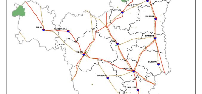
Haryana is Developing GIS-based Digital Map of Forest Areas in the State
According to the recent news, Haryana forest department is using geographic information system (GIS)-based digital mapping of forest areas in the state, this will add better monitoring and conservation of
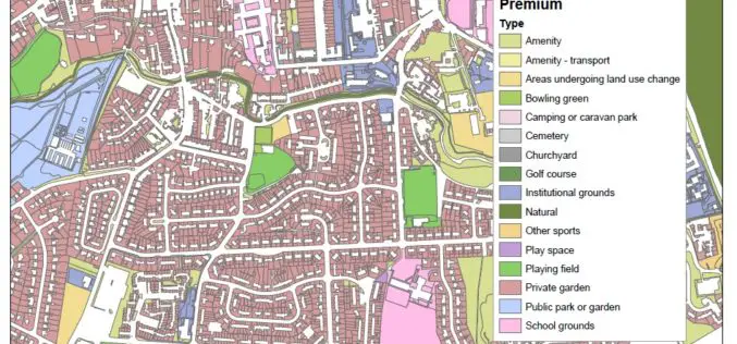
New Dataset of Accessible Greenspace for Scotland
A new digital map of every publicly accessible greenspace in Scotland will be released in March 2017. Recently the Ordnance Survey (OS) and the Scottish Government released an update on the project
Remote Sensing Technology to Boost Pisciculture
Chhattisgarh, India – The government of Chhattisgarh will undertake a survey using remote sensing technology for mapping the location of ponds, rivers and other water bodies to encourage fish farming in
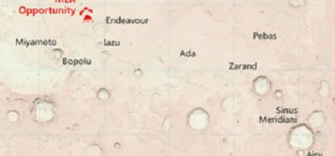
Ordnance Survey Has Created Map of the Martian Landscape
607 paper maps, the most detailed digital data picture of Great Britain, and now one red planet Using NASA open data, Ordnance Survey has created a one-off paper and digital map of

Design an Interactive Map SuperGIS Server
The biggest difference between a printed map and a digital map is that the digital map provides interactivity for users. For example, with GIS software, users can click on a

HERE to Explore Use of Big Data
The consortium of carmakers consisting of Audi, BMW and Daimler that owns digital map maker HERE said on Monday it would explore the use of big data to improve the

SuperGIS Supports Orienteering Club Charity Map Projects
Supergeo Technologies, the global leading GIS software and solution provider, announces that Star Vision Ltd., Supergeo Certified Reseller in Hong Kong, Macau and Guangdong, utilizes SuperGIS in a charity map
