
Tag "Flood hazard"
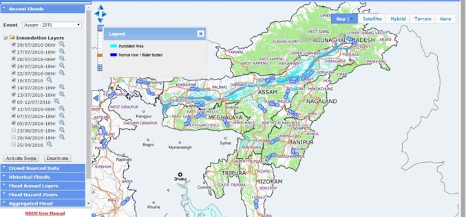
NRSC Released Updated Flood Hazard Atlas for Assam State
According to recent news by ISRO, the National Remote Sensing Centre (NRSC), ISRO, Hyderabad has released updated flood hazard atlas of Assam, a highly flood-prone state of India. Assam is
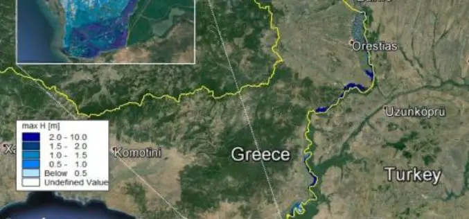
Conducting Flood Hazard and Risk Mapping For the Complex Evros River Basin
Z&A P. Antonaropoulos & Associates S.A. designed flood hazard and flood risk maps for the Greek part of the Evros River Basin after completing our MIKE FLOOD training course. The
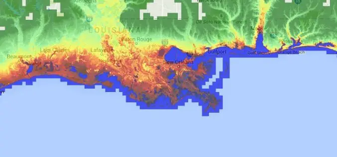
Accuracy Comparison of Publicly available DEMs and LiDAR DEM for Coastal Flood Risk Assessments
Coasts are experiencing the adverse consequences of hazards related to climate change and sea level rise and will be exposed to increasing risks of coastal flooding. Ten percent of the

FEMA Release Guidelines for Coastal Flood Hazard Analysis and Mapping
The U.S. Federal Emergency Management Agency has issued Guidelines for Coastal Flood Hazard Analysis and Mapping for the Pacific Coast of the United States. FEMA’s mission is to support citizens and
