
Tag "flood mapping"
GIS
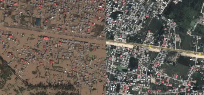
J&K Moves for Geospatial Modeling of Rivers for Flood Preparedness
J&K was severely affected by flood in September 2014, learning the lesson from past the J&K Government is planning to prepare 3D maps of terrain using geospatial techniques. Digital Elevation

Courses
NASA Training on Remote Sensing Observations for Flood Management
The goal of the NASA Applied Remote Sensing Training (ARSET) is to increase the utility of NASA earth science and model data for policy makers, regulatory agencies, and other applied
GIS
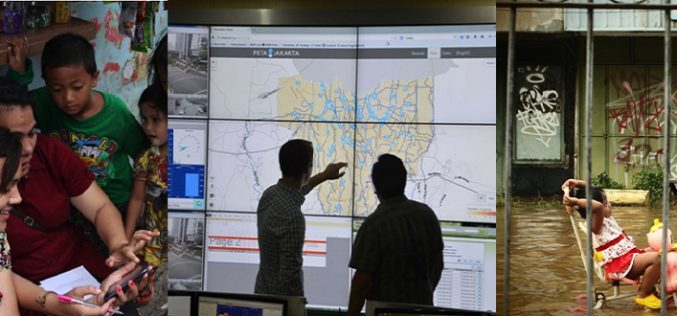
First-in-the-World: Indonesia is Using Tweets to Map Floods in Jakarta
Researchers have taken up the geospatial technology to a new horizon in Indonesia by using tweets from Twitter to map floods in Jakarta. Jakarta suffers from widespread annual flooding during
