
Tag "Geoscience Australia"

Ginan an Open-Source Real-Time Positioning Correction Service
As the demand for highly accurate positioning systems grows, Geoscience Australia has launched Ginan, an open-source real-time positioning correction service. Developed as part of the Positioning Australia program, Ginan offers
Australia’s Coordinates out by More Than 1.5 m
The Australian continent tectonic plate is moving 7 cm a year (and colliding with the Pacific Plate, which is heading west 11 cm a year) and experts at Geoscience Australia

A New Era of Space Collaboration between Australia and U.S.
On June 18, 2015 in Canberra, Australia, the U.S. Geological Survey and Geoscience Australia signed a comprehensive new partnership to maximize land remote sensing operations and data that can help
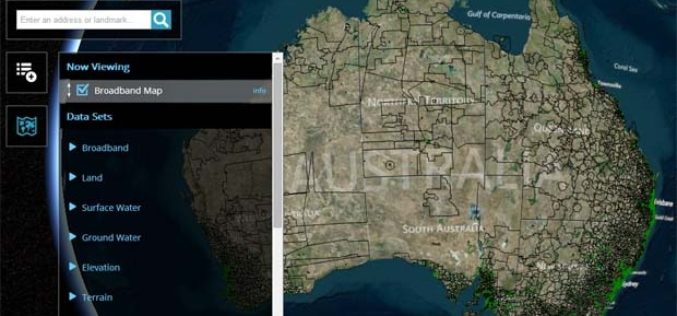
Australian Government Launches National Map Open Data Initiative
In recent news, Australian Government has launched a single platform for number of the data sets released by the government. With the launch of National Map Open Data Initiative, people

Isotropic Depleted Mantle Model Age Map of Australia
Geoscience Australia has released the Samarium-Neodymium (isotope) depleted mantle maps of the Australian continent. This view included the investigation of Australia’s lithospheric architecture to establish a whole-of-lithosphere architectural framework as a
