
Tag "geospatial"
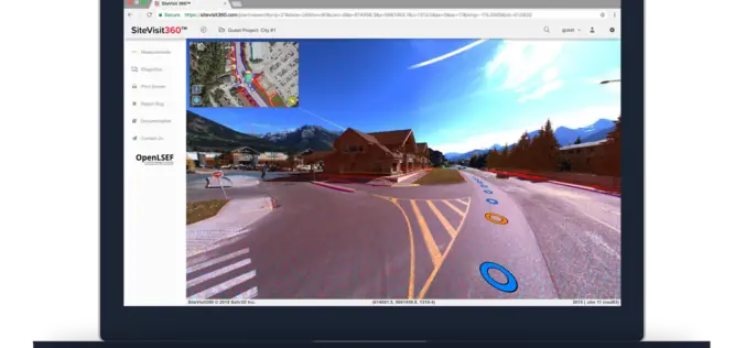
Solv3D Releases New Features Within SiteVisit360 Geospatial Collaboration Platform
CALGARY – September 6, 2018 – Solv3D, a leading provider of 3D processing, geospatial data visualization and collaboration tools announced that a number of new features were currently released within SiteVisit360™,
UrtheCast and Land O’Lakes, Inc. Announce Term Sheet for Purchase of Geosys
Acquisition will create a unique, fully integrated imagery data and geoanalytics solution in the agribusiness industry. VANCOUVER, August 14, 2018 — UrtheCast Corp. (TSX: UR) (“UrtheCast”) and Land O’Lakes, Inc.

LiDAR Aerial Photo Bluesky Aerial Survey Helps Malta Develop GeoSpatial Infrastructure
July 31, 2018 – Aerial mapping company Bluesky has captured aerial photography and 3D map coverage of Malta. Working alongside tender lead IIC Technologies and Ordnance Survey, Bluesky captured ultra-high resolution
Geospatial Intelligence Startup Ursa Announces $5.7 Million in New Funding
Plans to expand global monitoring capabilities for high impact business applications ITHACA, NY – July 19, 2018 – Ursa Space Systems, a provider of geospatial intelligence solutions, recently announced $5.7 million in

Cyient Selected to Develop GIS and MIS for the Varanasi City
Cyient has been selected as a consultant by Varanasi Nagar Nigam (VNN) to develop geographical information system (GIS) and Management Information System (MIS) for the city. A part of the

Geospatial Technology for Development of Smart Villages
Lucknow, Jul 15, 2018 (PTI) – Use of geo-spatial techniques like remote sensing can be of immense help in identifying villages lacking in basic infrastructure and ensuring their all round development

Novara GeoSolutions Unveils New Geospatial Product in Oil & Gas Industry
Norwell, MA – July 2, 2018 – Novara GeoSolutions (Novara) (www.novarageo.com), the industry’s leader in geospatial software and services for pipeline assets, announces the launch of a new product that is intuitive and
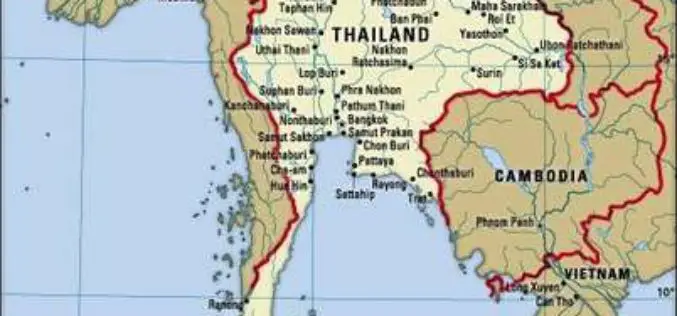
Airbus to Provide an End-to-end Geo-Information System to Thailand
Earth observation satellites, capacity building, integrated geo-information platform to support the Kingdom of Thailand’s key development priorities The Geo-Informatics and Space Technology Development Agency of Thailand (GISTDA) has selected Airbus
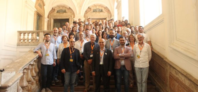
LANDSUPPORT Project Determines The Impact of Land Use
The EU funded LANDSUPPORT project officially launched on May 1st. The project partners, an international and complementary group of research centres, SMEs and policy makers, aim to develop an integrated
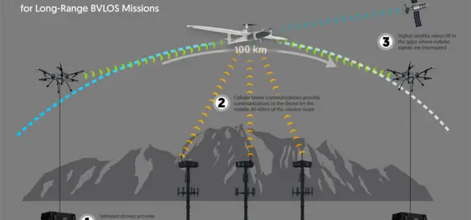
Kongsberg Geospatial Airspace Awareness Software to be used by 3 of the 4 Teams Selected by Transport Canada for BVLOS Flight Trials in Canada
Ottawa, CA, June 12, 2018 – Kongsberg Geospatial Ltd., an Ottawa-based geospatial and Air Traffic Management visualisation software company announced today that its IRIS technology will be used by three
