
Tag "GNSS"

Webinar: “Pairing” Bad Elf and TerraGo Edge: High Accuracy GPS Data Collection You Can Fit in Your Pocket
TerraGo Webinar: “Pairing” Bad Elf and TerraGo Edge: High Accuracy GPS Data Collection You Can Fit in Your Pocket April 7, 2015; 12:00 – 12:30 PM ET When you combine the Bad
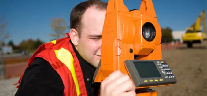
The 5most viewedTotal Stations on Geo-matching.com
The Geo-matching.com website features a selection of the most important geomatics equipment, including Total Stations. At www.geo-matching.com you can compare product specifications and read users’ reviews before you buy. Geo-matching.com

Survey Earth in a Day 4D
Survey Earth in a Day 4D June 21, 2015 – 4th Annual Global Celebration of the Land Surveying Profession Welcome Surveyor! At Noon, on the day of the solstice, June 21,
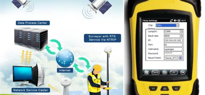
SuperPad Reveals NTRIP Solution to Achieve Centimeter Level Accuracy
Supergeo, the leading GIS software and solution provider, is going to release NTRIP solution on its Windows Mobile GIS app, SuperPad, for high accurate field data collection and geospatial workflow

High Accuracy and Advanced Field Work with Latest SuperSurv
To meet the great needs of high accuracy field data collection and better workflow via modern GNSS technology, Supergeo, the leading GIS software and solution provider, announces the latest SuperSurv
Topcon Announces New Millimeter GPS Laser Transmitter
LIVERMORE, Calif., USA/ CAPELLE A/D IJSSEL, The Netherlands – 3rd February 2015 – Topcon Positioning Group announces the release of the next generation laser transmitter for use with its Millimeter

Trimble’s Pocket-Sized R1 GNSS Receiver Enables High-Accuracy Data Collection with Smart Devices
Professional-Grade Location Accuracy Using Consumer Smart Phones and Tablets Trimble introduced today the R1 GNSS receiver, a pocket-sized, rugged, standalone receiver that works with iOS, Android or Window® mobile handhelds,
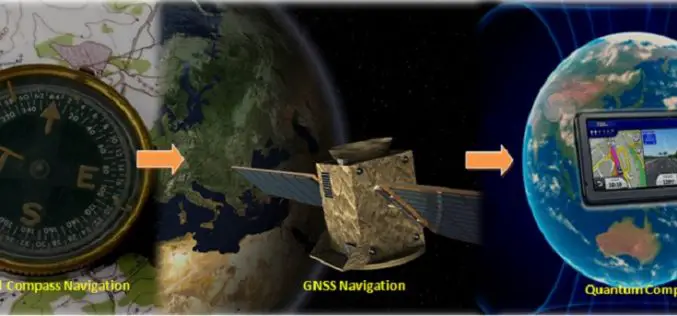
Will Quantum Compass Replace Global Navigation Satellite System (GNSS)?
Submitted by: Understanding the location on the planet Earth is always been important for human beings. In ancient time humans were using celestial objects or astronomical observations to determine their
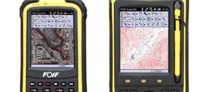
High Accuracy GIS Total Solution by FOIF SuperGIS
Supergeo Technologies, the global leading GIS software and solution provider, announced the cooperation with Suzhou FOIF Co. (FOIF) in providing worldwide surveyors with high accuracy GIS turnkey solution. Mobile GIS

Topcon Adds Imaging Capability to DS-200 Total Station Series
Topcon Positioning Group announces the addition of imaging capability to its direct aiming line of motorized total stations. The DS-200i provides real-time, touch-screen video and photo imaging to capture measured
