
Tag "LiDAR"
LiDAR, Point Cloud and SuperGIS Desktop 10
Have you ever thought of using LiDAR data through geographic information system to improve field tasks such as Forestry Management, Disaster Prevention, Coastal Change Management, and Contamination Simulation and so
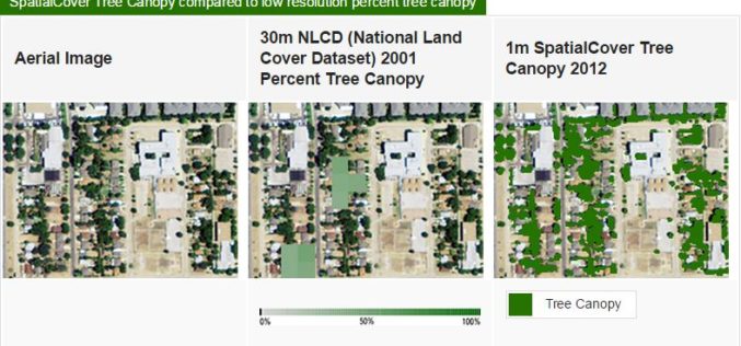
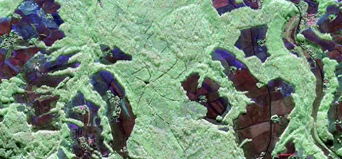
High Resolution Tree Mapping for Minnesota
EarthDefine has created a high resolution tree mapping datasets for Minnesota’s tree in unprecedented detail. The high resolution seamless tree canopy dataset for Minnesota have 98% accuracy and 30 times
Aircraft Likely To Be Used For Mapping Ganga Basins to Rid It of Pollution
Fitted with powerful cameras, Special Purpose Aircraft may soon fly over the Ganga to survey the river as it courses through five states for a geospatial mapping of its basin
Telangana Government to Take Up LiDAR Survey of Barrages and Canals
As reported in The New Indian Express, the Telangana Government is all set to start the LiDAR survey of the altered Pranahita – Chevella project from August 18. The state government

GeoShot Technologies Completed Large City Modeling Project Using LiDAR Data
GeoShot Technologies has successfully completed large city modeling using LiDAR data. “We are very excited to complete the first large scale city modeling project at GeoShot Technologies at a time
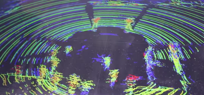
Implementing LiDAR Technology in Transportation System
Brian Davis a Research Fellow at University of Minnesota is working on LiDAR (light detection and ranging) technology for implementing in transportation systems. Davis and his fellow researchers have outfitted a

Telangana State to go for Topographical Survey of Godavari River
According to recent news in Indian Express, the Telangana state government is determined to optimal utilization of allocated Godavari water falls. The state government has decided to go for topographical

Open Source Software for Bulk LiDAR Data Processing Released
Developed for Forest Carbon Monitoring to Support Reducing Emissions from Deforestation and Forest Degradation (REDD+) in Kalimantan, Indonesia; Now Available for Public Use. For this project, Applied GeoSolutions and the
3D Measurements of Forest Areas
A tangle of treetops and branches, through which just the occasional clear area provides glimpses of the trunks and roots growing below. Whether it is woodland with German spruces or

Trimble joins LASzip sponsors USACE, NOAA, and Quantum Spatial
July 13, 2015-Gilching, Germany – We are happy to announce that Trimble’s Geospatial Division has become a sponsor of the LASzip compressor. Their contribution as a Bronze sponsor will improve the existing
