
Tag "mapping"

3D Maps of Buildings to Improve Disaster Management Plans
India – In order to improve disaster management plans, the Gurgaon administration has decided to prepare 3D maps of 100 buildings in the city, including office complexes and hospitals. Gurgaon
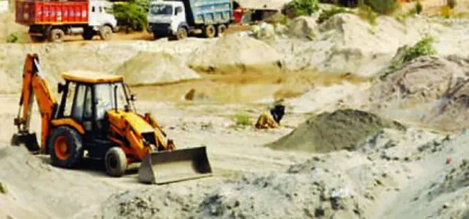
Geospatial Mapping to Curb Illegal Sand Extraction
India – The Goa State Expert Appraisal Committee (GSEAC) has issued instructions to the District Collectors to carry out survey and mapping of sand extraction lease boundaries through Global Positioning

GIS Partnership to Aid Removal of Land Mines
Geneva International Centre for Humanitarian Demining to Employ Latest Esri Mapping Technology in Worldwide Efforts Redlands, California—Esri and the Geneva International Centre for Humanitarian Demining (GICHD) signed a memorandum of
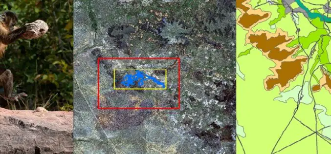
Remote Sensing Technology Is Used to Map Monkey with Hominid like Behavior
Biologists are fascinated by the applications of remote sensing and geographic information system (GIS) to the characterization of wildlife habitats as an area of growing significance for conservation. “Remote sensing

Escape the Obvious With the Ordnance Survey Graduate Scheme
Ordnance Survey graduate recruitment scheme for 2016 has launched, offering graduates the opportunity to lead the way on developing innovative and inspirational solutions for digital data. Ordnance Survey is looking for talented,

Protecting Cultural Heritage with Smart Mapping Technology
Penang’s rich colonial heritage and globally recognised architecture have been transformed into a virtual smart map Malaysia – George Town World Heritage Incorporated (GTWHI) with their mission to preserve, protect

High Resolution Satellite Imaging to Locate Village Where Parasites Causing Permanent Blindness
In an achievement by Sara Amirazodi, a junior majoring in Earth system science (ESS), University of Alabama in Huntsville was awarded by one of three $1,000 scholarships presented to DEVELOP

Topcon Announces Rotary-wing UAS
LIVERMORE, Calif. – October 5, 2015 – Topcon Positioning Group announces the addition of a rotary-wing unmanned aerial system (UAS) to its mass data collection solutions line. The Falcon 8
Satellite Mapping of National Highways
In recent news by Business Standard, the National Highways Authority of India (NHAI) is planning to sign a memorandum of understanding (MoU) with the Indian Space Research Organisation (ISRO) to adopt
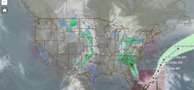
nowCOAST – a Web Mapping Portal to Real-Time Coastal Observations, Forecasts, and Warnings
With Hurricane Joaquin approaching the eastern coast of the United States, anyone looking for reliable NOAA weather mapping services can use the recently launched updated version of NOAA/National Ocean Service’s nowCOAST, a
