
Tag "maps"

Government of South Australia Releases Geoscientific Data
The State Government has released a major package of geoscientific data in one of the State’s most underexplored provinces. Speaking today at the 8th annual Mining South Australia Conference in

Deputy Prime Minister Announces Plans for a New Map of Accessible Green Space for England and Wales
03 Sep 2014 – The Deputy Prime Minister, Nick Clegg, today announced that Ordnance Survey would compile and release data to allow for a new map of every publicly accessible green

China Distributes Millions of Controversial Maps to Troops
Beijing: China is distributing millions of controversial updated maps to its military in the first upgrade in 30 years, reportedly reinforcing its claims over Arunachal Pradesh. All major army units will
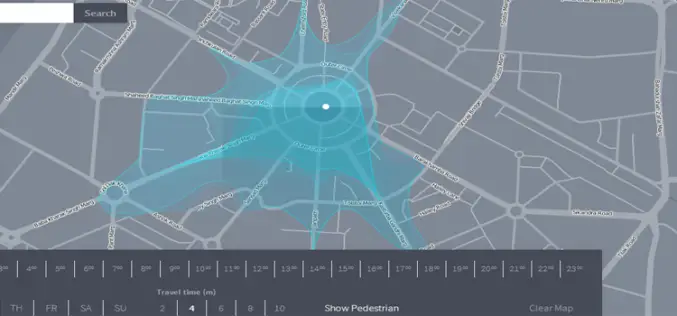
Isoscope a New Way to Explore and Visualize Mobility
We have been using Google Maps to find out the directions, distance and even real time navigation with estimated travel time according to traffic situations. But a team of developer in

PR: PolicyMap Releases New Mapping Tool for the Masses
Self-Service Web Tool Turns Open Data into Useable Data PolicyMap is putting data mapping tools in the hands of the masses with a new Web tool that launched today at www.policymap.com.
Web Maps for WordPress Plugin Connects with ArcGIS Online
Web Maps for WordPress is the best way to quickly and easily search for and insert authoritative maps directly into your blog posts and pages. Quickly and easily search and
