
Tag "Mosaic"
GIS
GIS Data
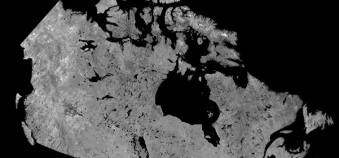
Download Free RADARSAT Data of Canada
Canada’s RADARSAT-1 is a radar satellite and was launched in November 1995. It carries a Synthetic Aperture Radar (SAR), it acquired images of the Earth day or night, in all

Webinars
Webinar: Generating Point Clouds with SimActive Correlator3D Version 6.1
Generating Point Clouds with SimActive Correlator3D Version 6.1 Wednesday, April 15, 2015 10:00 pm (Eastern Daylight Time) Correlator3D Version 6 introduced a revolutionary new interface for streamlined image processing of

Business
Software
SimActive Introduces Game-Changing Technology for Mosaic Creation
SimActive Inc., a world-leading developer of photogrammetry software, is pleased to announce Correlator3D™ version 5.4, with significantly faster mosaic creation and a further increase in quality. The process has been
