
Tag "Pix4Dag"

Business
MicaSense Atlas is Now Integrated with Pix4D Desktop Software
This partnership is designed to offer MicaSense customers the power of desktop processing, as well as the flexibility of MicaSense Atlas. “Our customers value Atlas as an analytics and collaboration
Remote Sensing
The Power of Offline Processing: Why Desktop is Essential for Drone Mapping in Agriculture
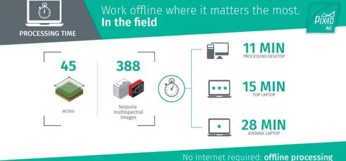
Part 2: Processing in the Field In Part 1 of this mini-series we went over why it makes sense in agriculture to import images directly to Pix4Dag Desktop. We concluded that

GIS
In Defense of Desktop: Why Desktop is Essential for Drone Mapping in Agriculture
Part 1: How quickly can you go from landing to processing? If you want an NDVI map while you’re still in the field, cut out a potentially long upload to
