
Tag "SRTM"
Global Mapper 18.2 Released with New 3D Digitizing Functionality and Support for Connecting to Amazon Web Services
Hallowell, Maine – May 30, 2017 – Blue Marble Geographics (www.bluemarblegeo.com) is pleased to announce the immediate availability of Global Mapper version 18.2. This latest upgrade to the version 18
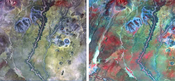
NAU Scientist Uses Remote Sensing to Detect Groundwater in Drought-stricken East Africa
Drought is a condition when a region notes a deficiency in its water supply whether surface or underground water. A drought can last for months or years, or may be declared
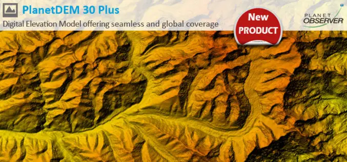
PlanetDEM 30 Plus: The New Global Digital Elevation Model at 30-Meter Resolution Offering Seamless, Reliable and Accurate Data
PlanetObserver, specialist of geospatial data production for more than 25 years, announced today the release of PlanetDEM 30 Plus global elevation model. PlanetDEM 30 Plus is the new Digital Elevation
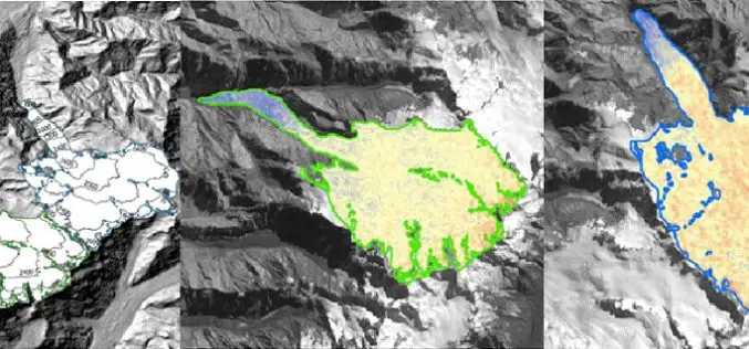
Modeling Glacier Elevation Change from Time Series DEM
Glaciers are always having an important impact on environment. Changing climate conditions have put a lot of pressure on our glaciers. Melting of glaciers could be very dangerous for life
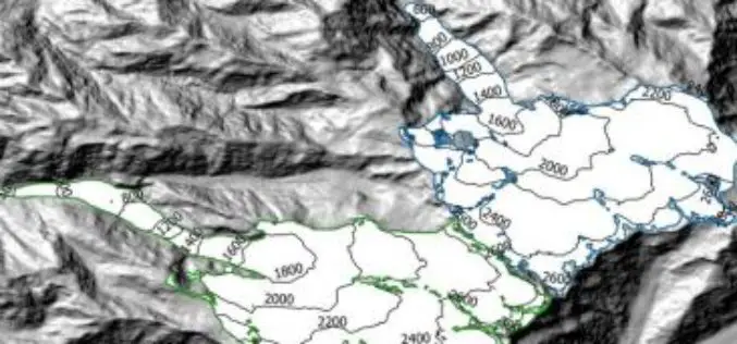
Modeling Glacier Elevation Change from DEM Time Series
Modeling Glacier Elevation Change from DEM Time Series – Wang, D.; Käb, A. Modeling Glacier Elevation Change from DEM Time Series. Remote Sens. 2015, 7, 10117-10142. Abstract: In this study, a methodology for
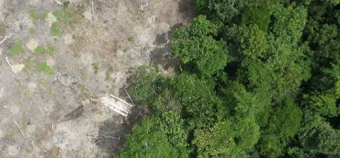
Radar Satellite Data for Mapping Dynamics of Deforestation and Forest Degradation
Have you ever think about the importance of forests in our daily lives of concrete jungles? Forests products are used in our daily lives. All activities directly or indirectly involve

3D Printing to Illustrate Agricultural Potential of Farmlands
The Department of Agriculture and Food, Western Australia has moved on next step with 3D printing of farmlands for clear illustration of agricultural potential of lands. The 3D printing is also
Discover Top 10 GIS Features with Latest SuperGIS Desktop
To make GIS software friendlier and easier to access, Supergeo, the leading GIS software provider, collects GIS users’ ideas around the world, and votes the 10 most useful features of
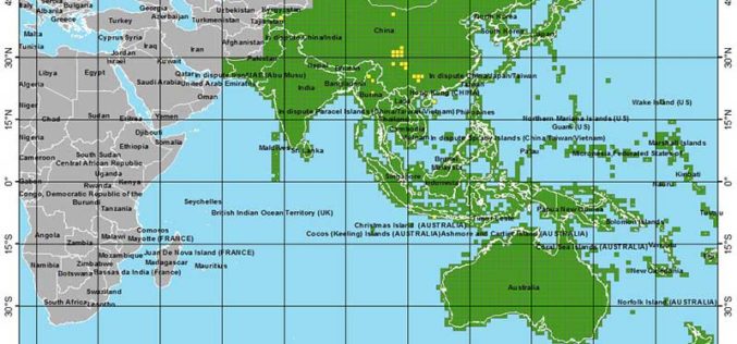
More Global Topographic Data to Aid Climate Change Research
Enhanced elevation data for most of Asia and Oceania; third of four releases Improved global topographic (elevation) data are now publicly available for most of Asia (India, China, southern Siberia,

Enhanced Elevation Data for North and South America, Pacific Islands, Northern Europe
New Heights of Global Topographic Data Will Aid Climate Change Research The U.S. Geological Survey announced today that improved global topographic (elevation) data are now publicly available for North and

